Studio3
Lloyd District Master-Modal Plan Development
All works shown were created by RHW Designs.
Analysis – Weeks 1 to 3
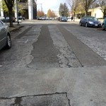
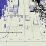
Photo Analysis
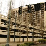
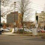
Starting with Analysis, the objective was to understand the context of the project. The Lloyd district has seen unusual development patterns relative to near-central city layout. In particular, the Lloyd district has become, since the 1950s, suburbia in the city. The mall overpowers the pedestrian access with a forest of parking structures. Office towers seem to have a ring of parking lots that encircle their gravitational pull – adsorbing vehicles, people, and daylight. And the unusually large “super blocks” (compared to Portland block standard) create interesting design opportunities.


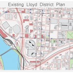
Paper Analysis
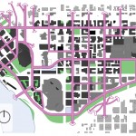
The vicinity map, printed at 1″ = 150′ on 42″ x 30″ is cluttered with markings, highlights and notes. By folding it into 1/8’s RHW was able to easily manuver the streets of the Lloyd District, block-by-block and score each node, landmark, building, and edge. The criteria were the following:
Building Aesthetic, Functionality, Appropriate Use} Black Pen: -, 0, +
Social Cohesion, Occupiability, Humanizing Elements such as trees} Blue Pen: -, 0, +
Infrastructure, Street Condition, Bike Lane, Sidewalk, Car Lanes} Red Pen: -, 0, +
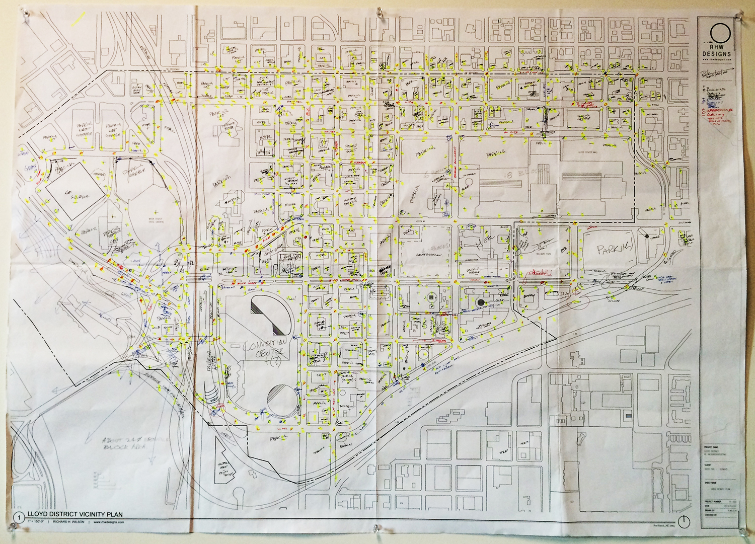
This scoring method helped to evaluate the relative condition of each block at a reasonable speed. The negative symbol indicated poor conditions, with the zero being neutral, and the positive symbolizing good conditions. These results were completely subjective however, and not founded on an accurate scientific approach. However for the sake of design and understanding possible successful analysis methods, for the time being, this process was extremely valuable. In the future, a more precise method would need to be utilized.
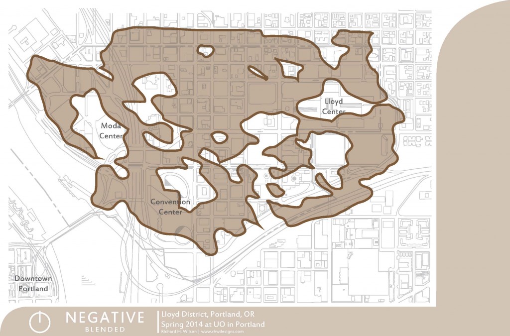
By clicking on the image below, more results may be seen in the respective colors. What may be seen are the areas that received negative values during the site analysis. These negative regions are those that were below acceptable conditions of Building, Social, and Infrastructure. The final images in the set combined the three together, and also blended them. Each map delivers a different set of useful information in helping to decide where improvement may occur, which was the intention for the very beginning.
Master-modal Plan Development – Weeks 4 to 5
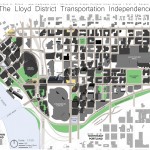
The Lloyd District plan has moved forward in a direction with the intention of finding three organizing planning methods: 1) Multimodal Plan Organization 2) Existing Quality Building Preservation 3) Densification Each of these helped the designer organize the overwhelming amount of possible problems and solutions into a consolidated approach. There are likely multitudes of other design approaches that may be considered in an urban design. For this 11-week studio design however, choosing, and sticking to, a few specific organizing design methods was a successful move. As the master designer, of course who can resit naming a few of the new plan elements after themselves? Notice the new waterfront “Hugh View Point Park,” and less easy to see is the new “NE RHW Way” which is a “CP” route along the raised waterfront.
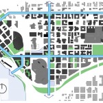
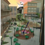
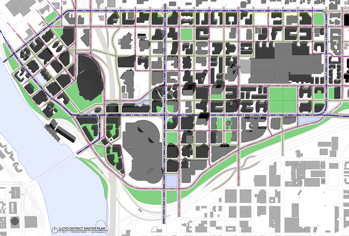
Masterplan
New blocks are highlighted in dark gray. Light gray geometry represent existing buildings that were either of high quality, or already use their respective site well. Take particular notice at the Moda Center area, which has removed the recently-deemed historical landmark of the Memorial Colosseum. Replaced with what is planned to be mixed-use housing. The neighborhoods will be identified in the following weeks into two categories of mixed-use development: 1) R&R (Rest & Retail); 2) OC (Office-Club). The Moda Center area will become one of three R&R neighborhoods within the district. 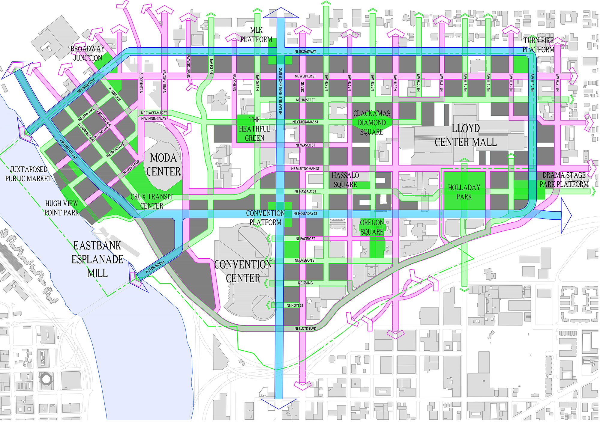
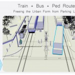
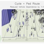
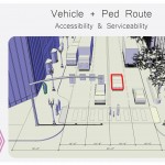
Separated Street Types
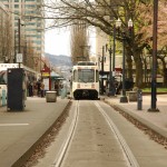
The intention here was to reduce inner-city dependence on the personal car, and to provide a higher priority to the ped, cyclist, and transit. 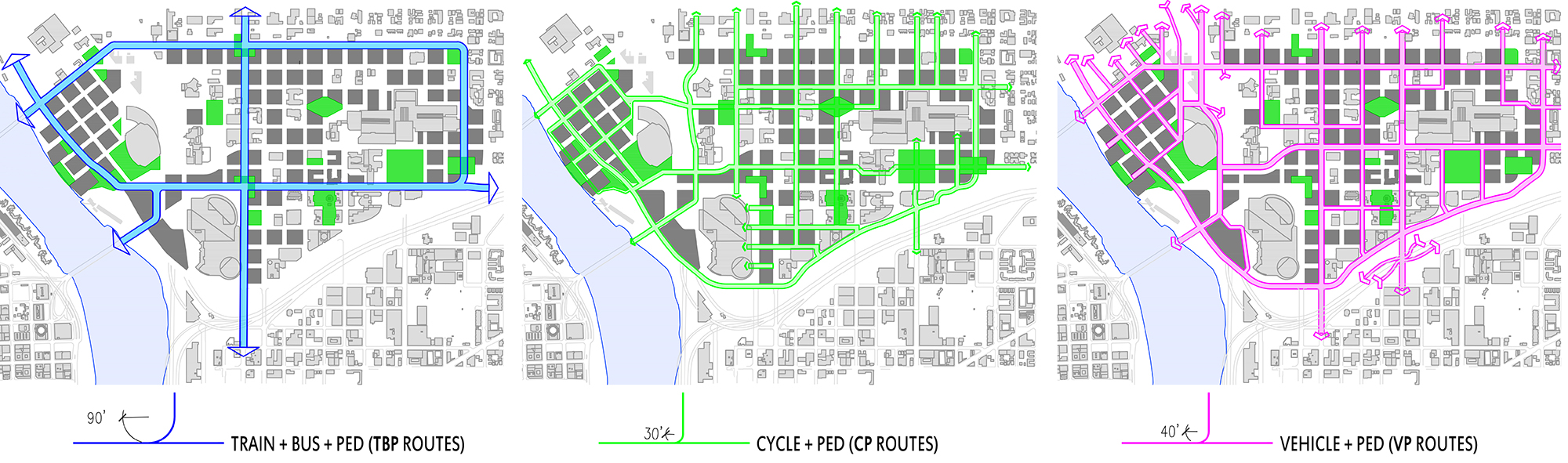
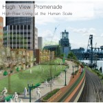
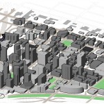
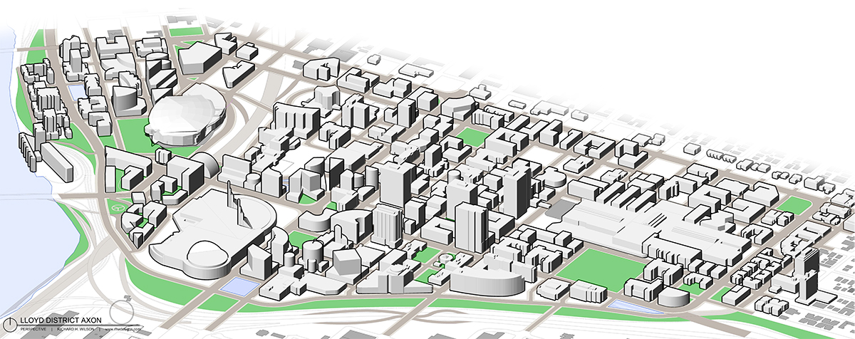
Densification Visualization – 3D Axon View
This is an early approach to deciding how the form of the Lloyd District may take shape. Intentionally left rough so as not to lock the designer into a particular set of densification strategies. It is likely that some reorganization will occur, in particular where the Steel Bridge enters the district. 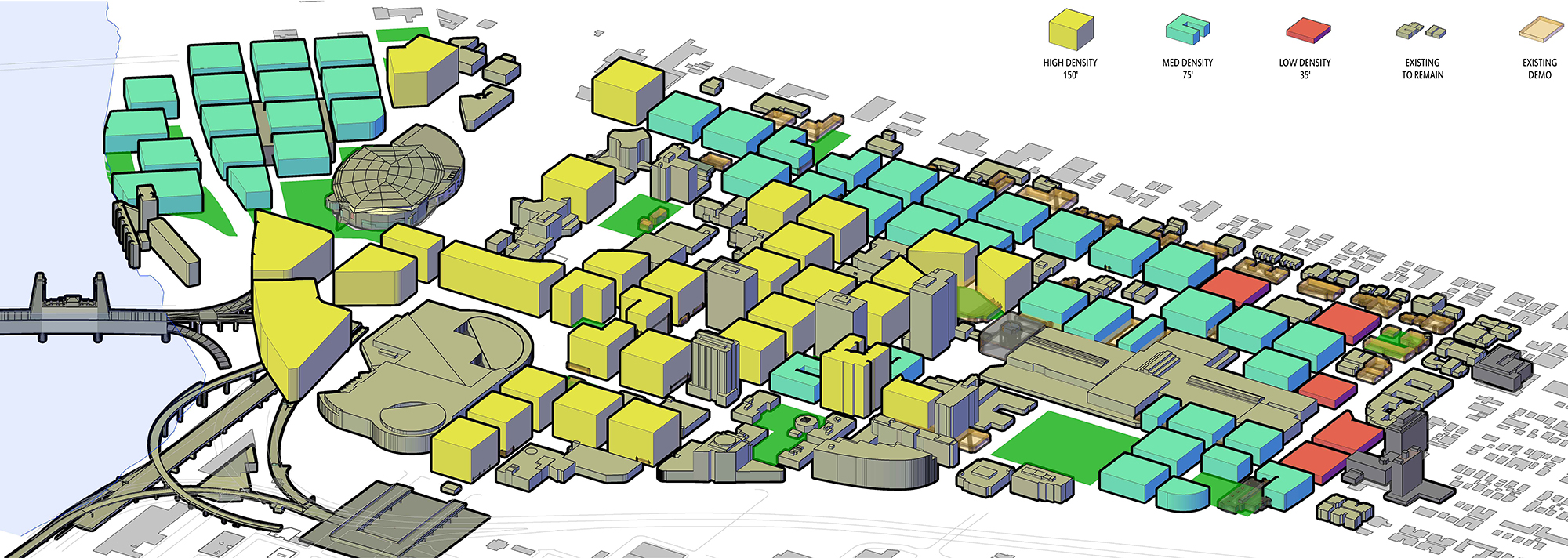
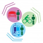
Modal Street Types
Semi-Final Presentation Imagery – Weeks 6 to 7
Three weeks remain leading up to the final Studio presentation of the Lloyd District Master-Modal Plan. For now, the following displays only the master site plan and an axon aerial view of the site. To follow are three specific neighborhood plans, each with vignettes at the human scale.
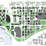
Masterplan
A myriad of design tool options were available to produce this masterplan. AutoCAD Architecture 2014 was chosen. For the sake of available time, simply continuing to work in the same medium throughout proved to be valuable. New buildings to the district are a darker shade of gray, and existing buildings are a lighter tone of gray (although the Moda Center encountered rendering complications, but is to remain unaltered).
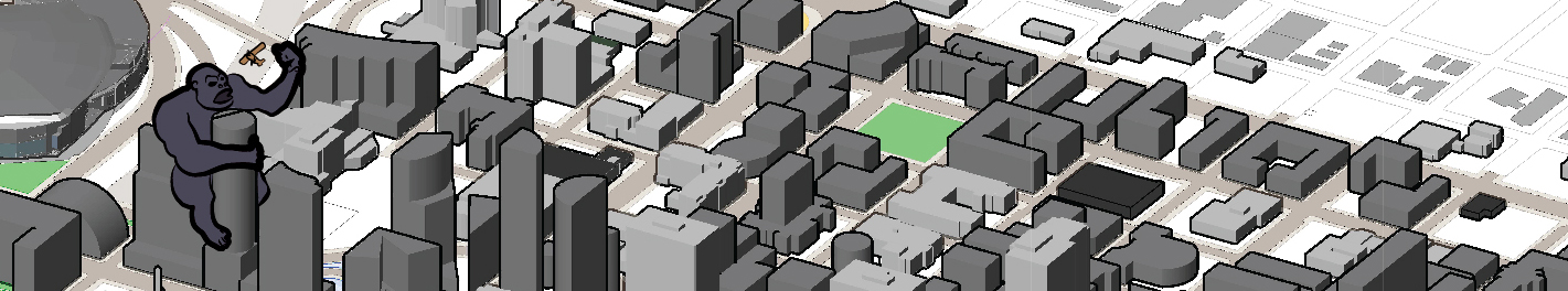
Site Axon Aerial View
It has not been decided currently whether the new buildings in the Axon View will be delineated differently than existing buildings (ignore the north arrow at the bottom left)…
Final Lloyd District Transportation Independence – Weeks 8 to 11
Final Presentation Board – 42″ x 72″ = $50
The final moment has come! The final board is complete, and ready to present. The journey was long, and painstaking. But in the end, much was learned.
The end result turned out to roughly follow the early intentions, which are:
1) Multimodal Proposal
2) Densification
3) Preserve Existing Quality Urban Fabric
The primary multimodal goal took most of the design effort, since transportation planning is such a monumental task in itself. This meant that the other two goals took a back seat during the project. However goals two and three were present throughout development.
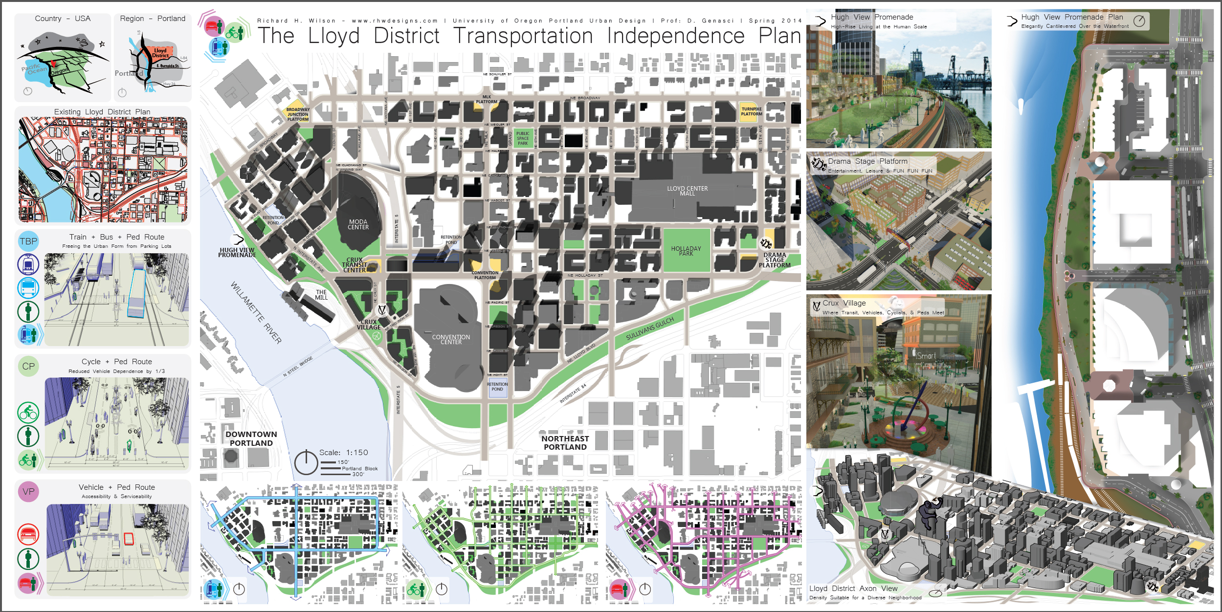
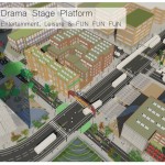
Closeups
The following are more detailed images of the presentation material.