Resiliency: Soft Waterfront Renewal & Urban Design
Research Monograph
Project from October to December, 2014
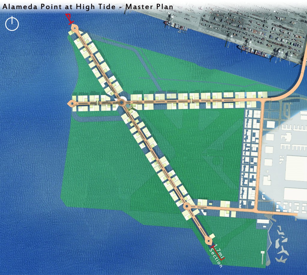
Proposition for a significant re-development strategy of Alameda Point, Alameda Island, CA.

Mission & Goals
This thesis project will respond to contextual issues in three ways:
- Resilient Design
- Waterfront Reclamation
- Compact Development
Resilient Design shall focus on sustainable, innovative, “future proofing” concepts. Waterfront Reclamation will attempt to promote and propose strategies to mitigate, accept or interact with waterfront issue. Compact Development is a reality that future developments must anticipate; so this project will encourage folks to find the best ways to live together.
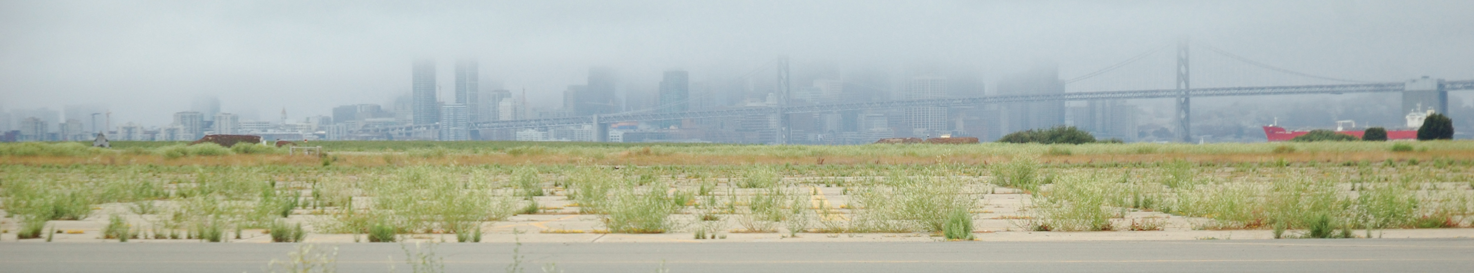
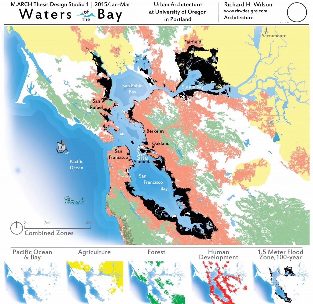
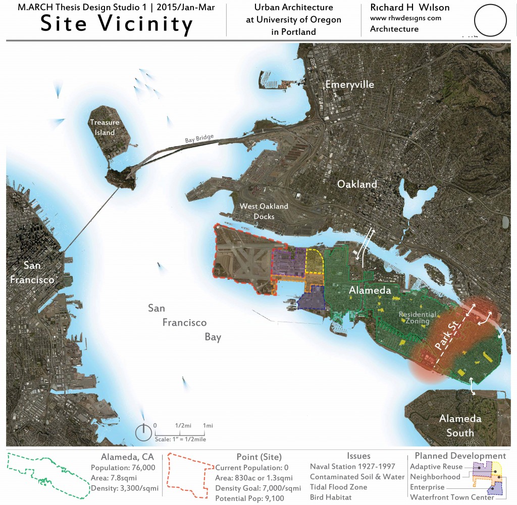
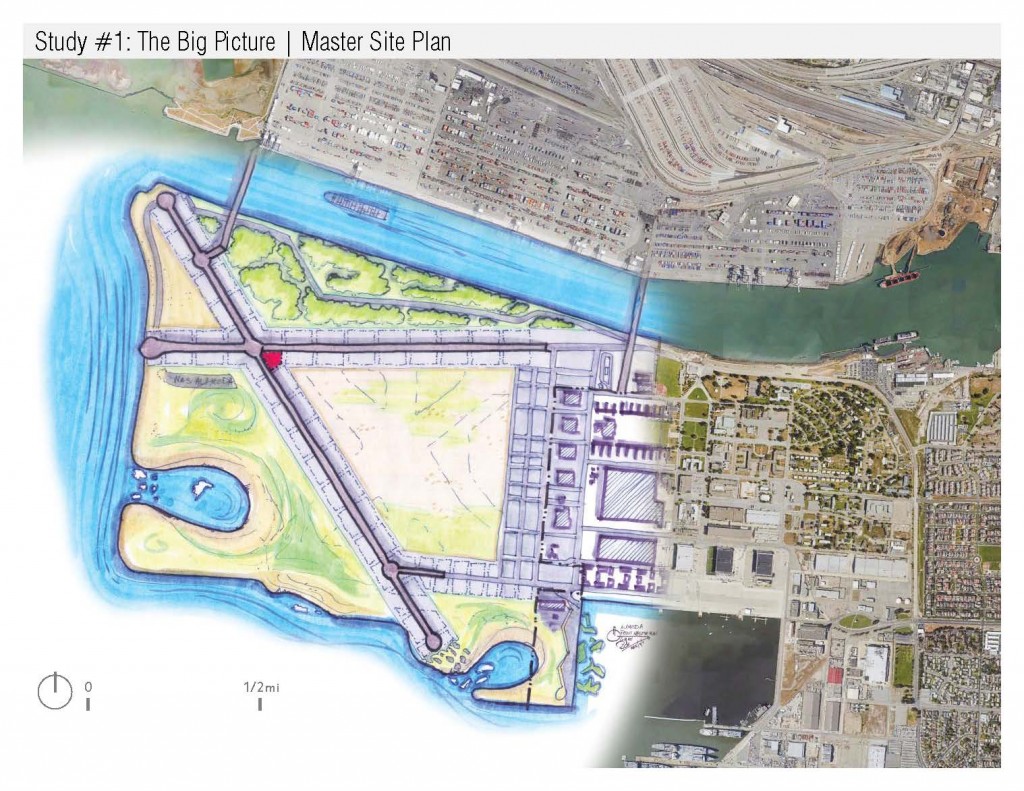
Study #1: Waters of the Bay
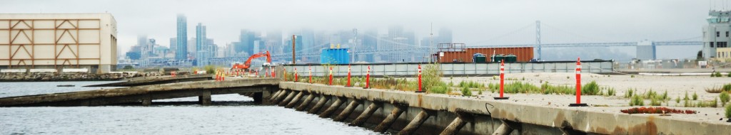
Sounds at the Alameda Point shore.
These maps were created by RHW with ArcGIS, AutoCAD, Photoshop and Illustrator. They delineate the major bodies of water which feed the San Francisco Bay Area. Additionally they show major program elements for the project proposal.
Study #2: Concept Design
Designs that investigate radically different architectural expressions. The original mission and goals were integrated into each.
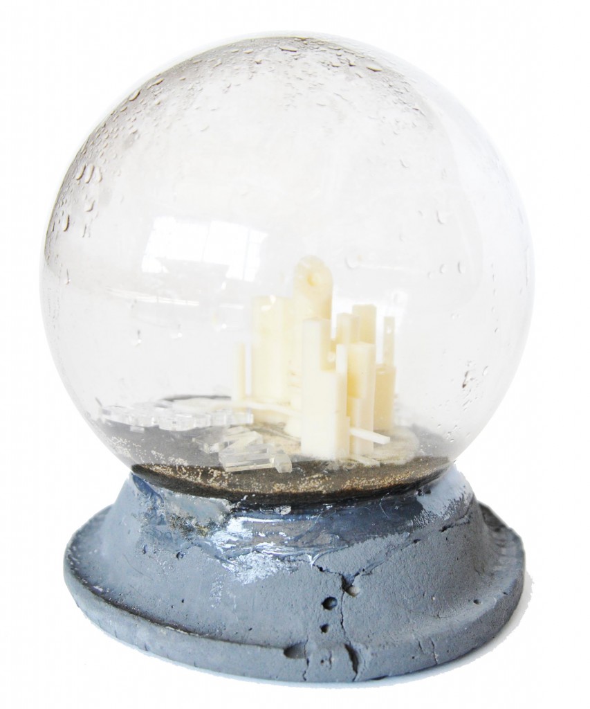
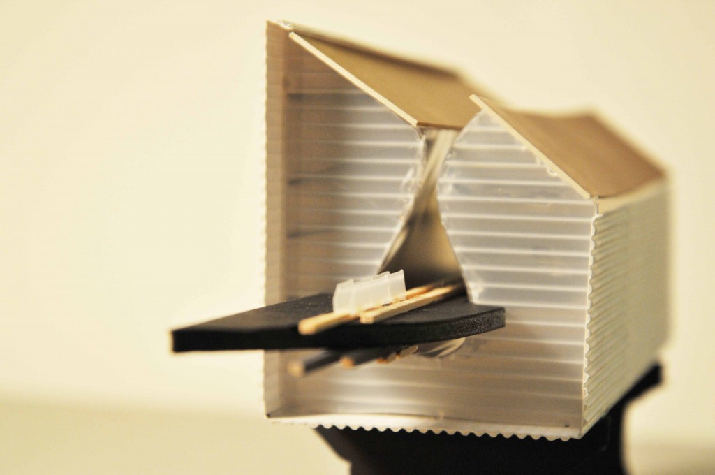
Sketch Model
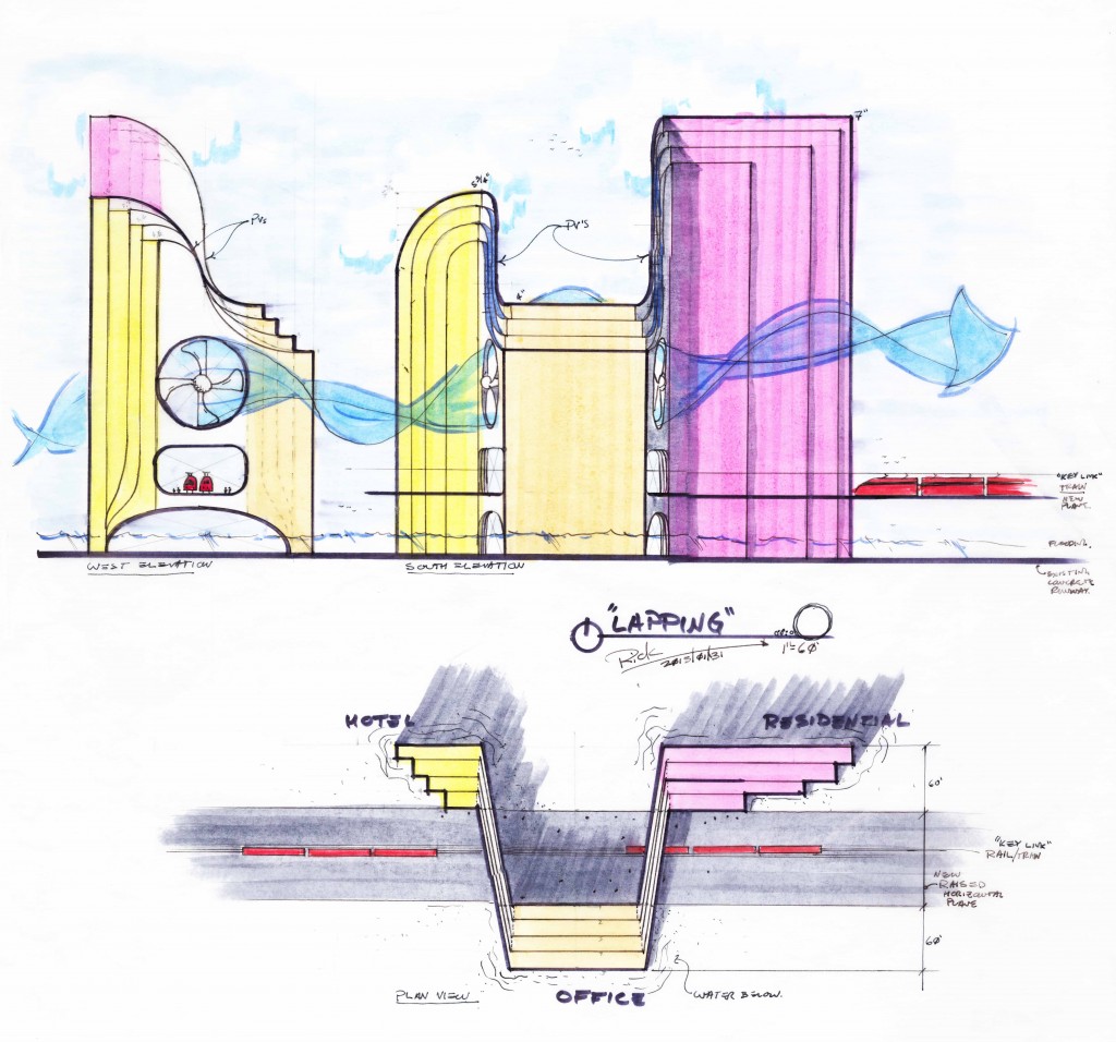
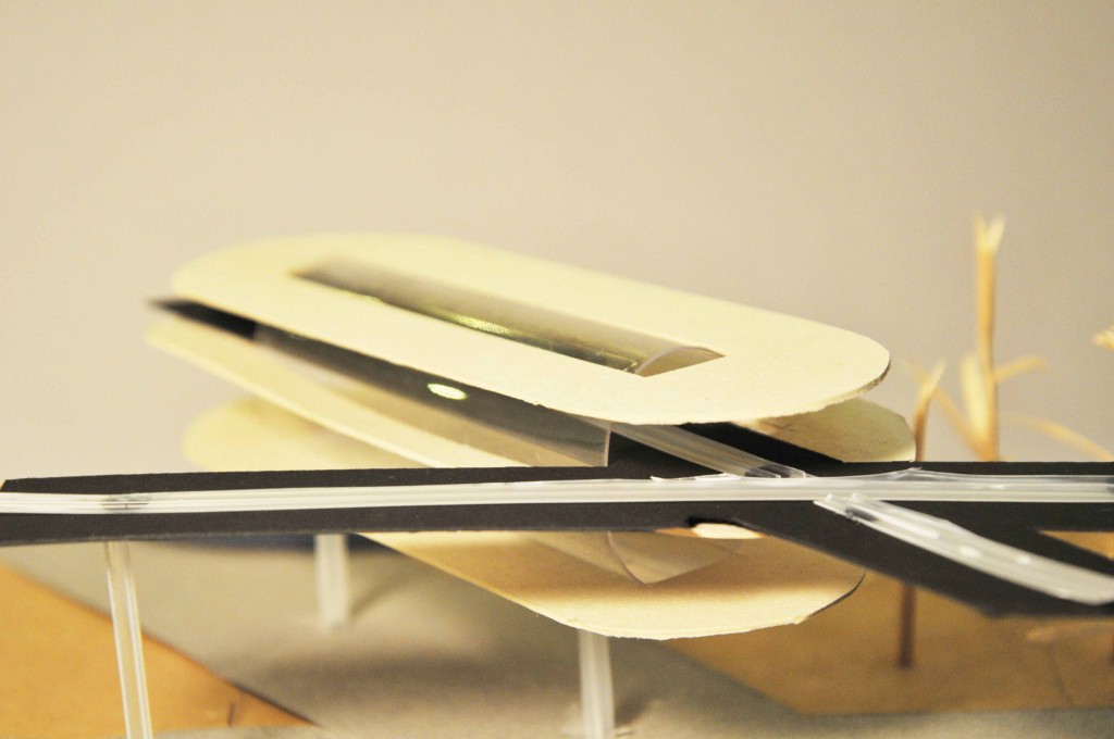
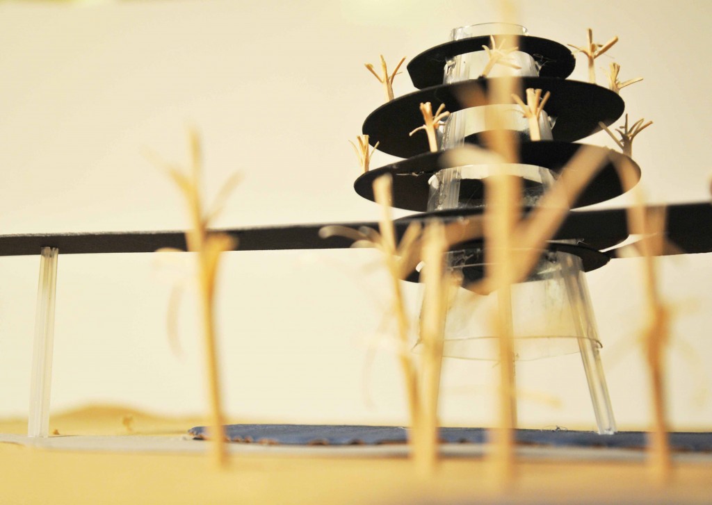
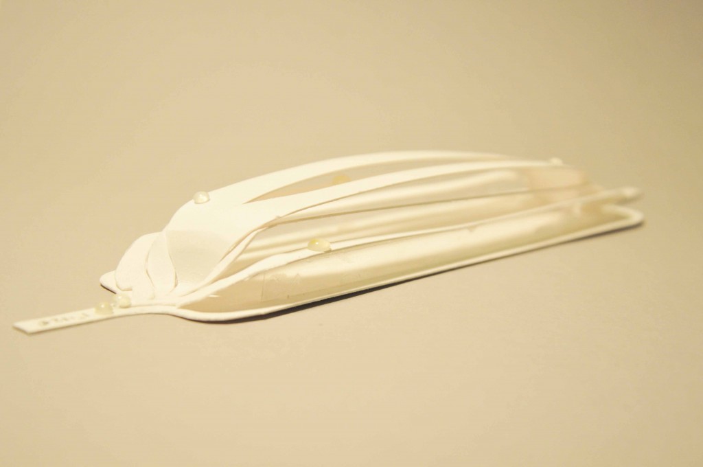
Sketch models. Each of these required between 3 and 13 hours to develop (depending on complexity). Although these models can take time, they ultimately may provide insight into the final design. This is particularly true on designs that require very complex geometry. For example, Overlap and Lapping required both hand sketches and physical modeling to understand whether some of the concepts would work. While cutting and gluing, these impossibilities became clear – which informed the design.
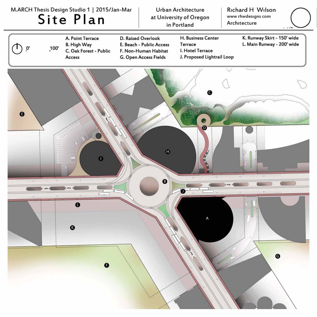
Resiliency
Presentation of Resiliency: Waterfront Renewal & Housing Design.
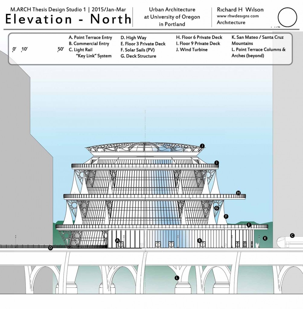
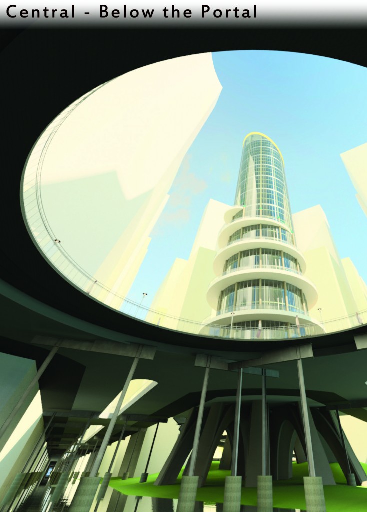
Vision
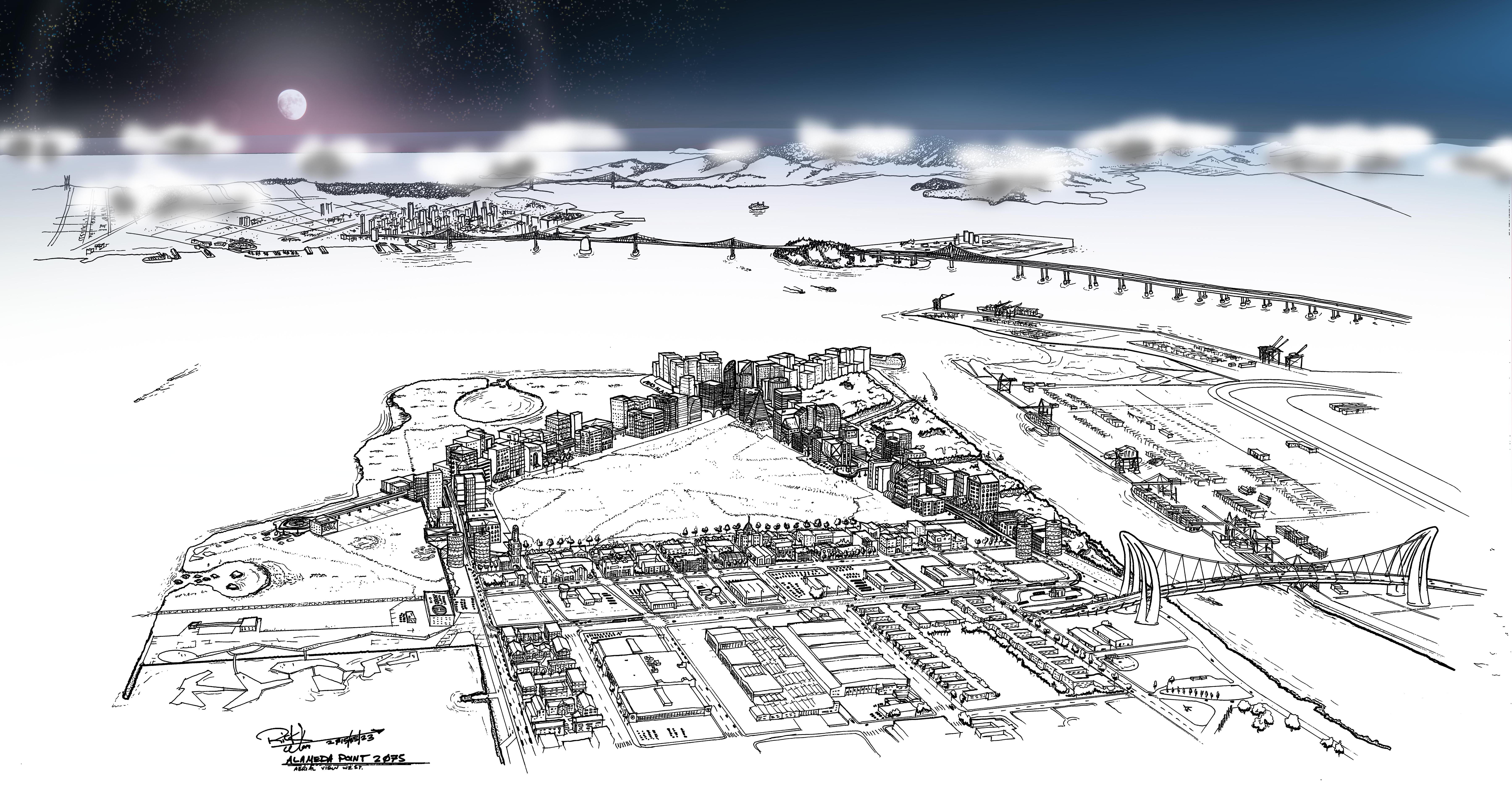
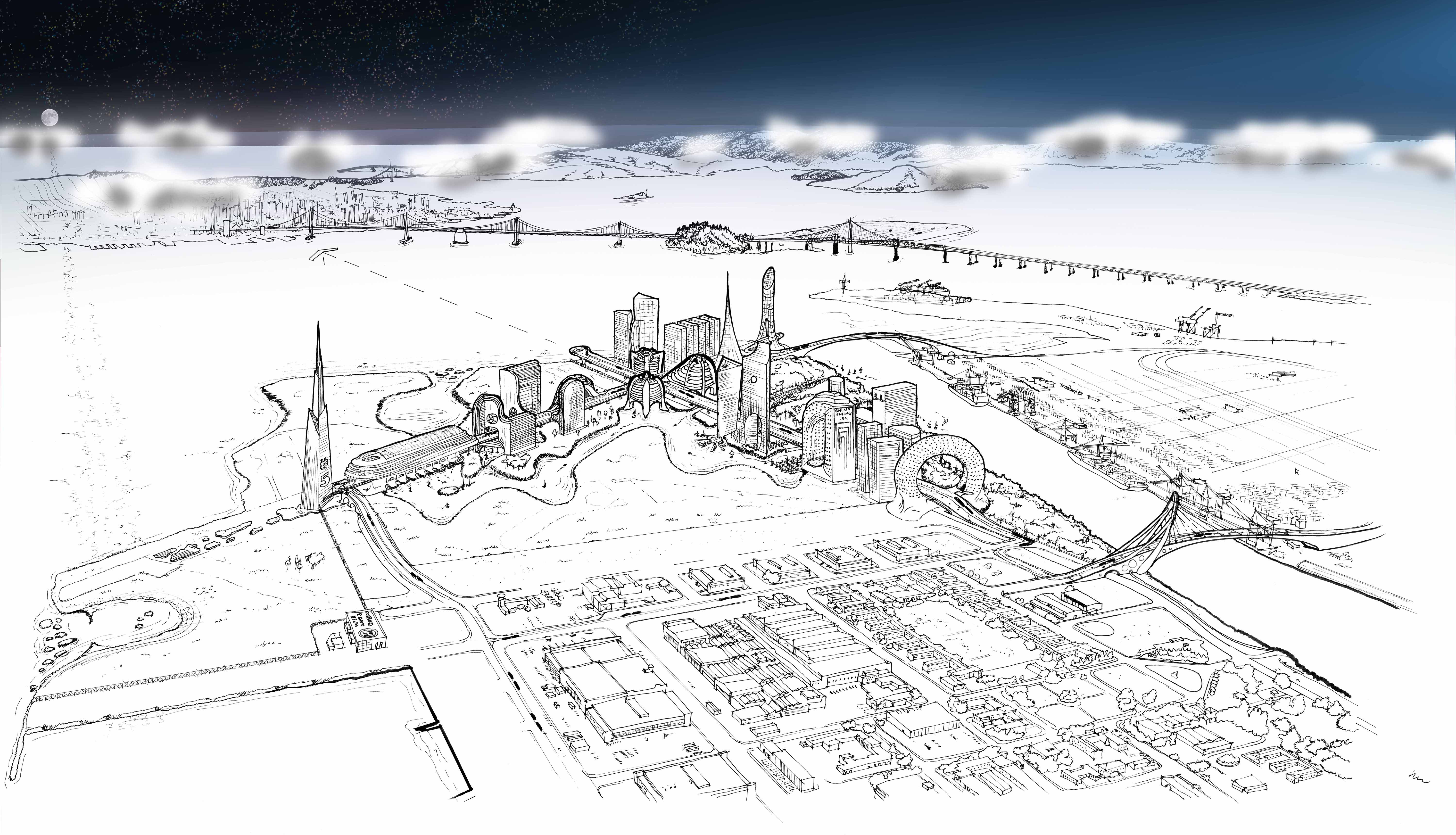
Aerial illustrative plan drawing at 24″x40″.
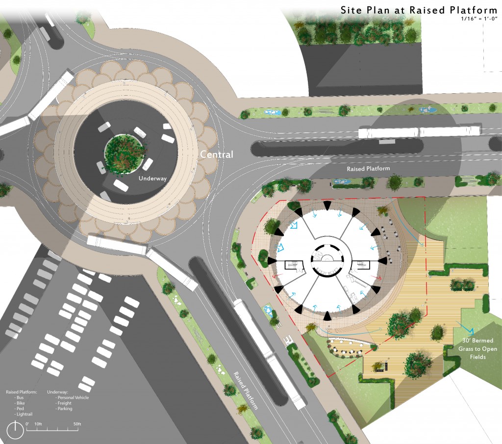
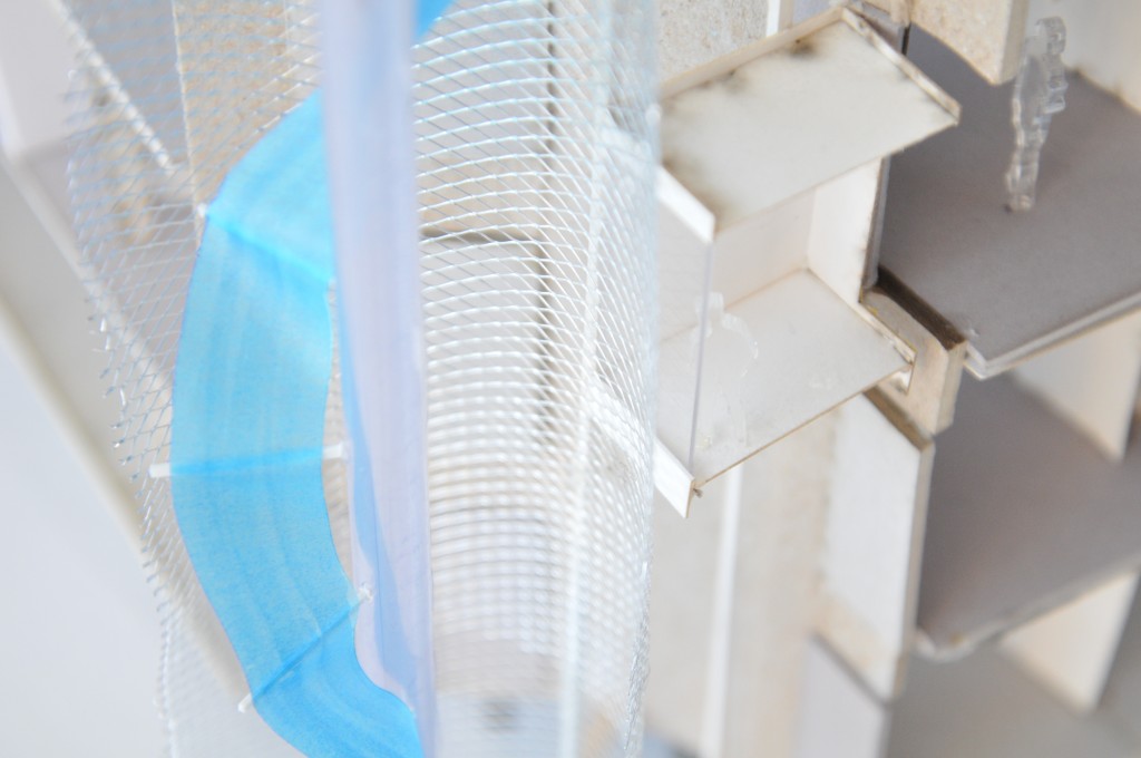
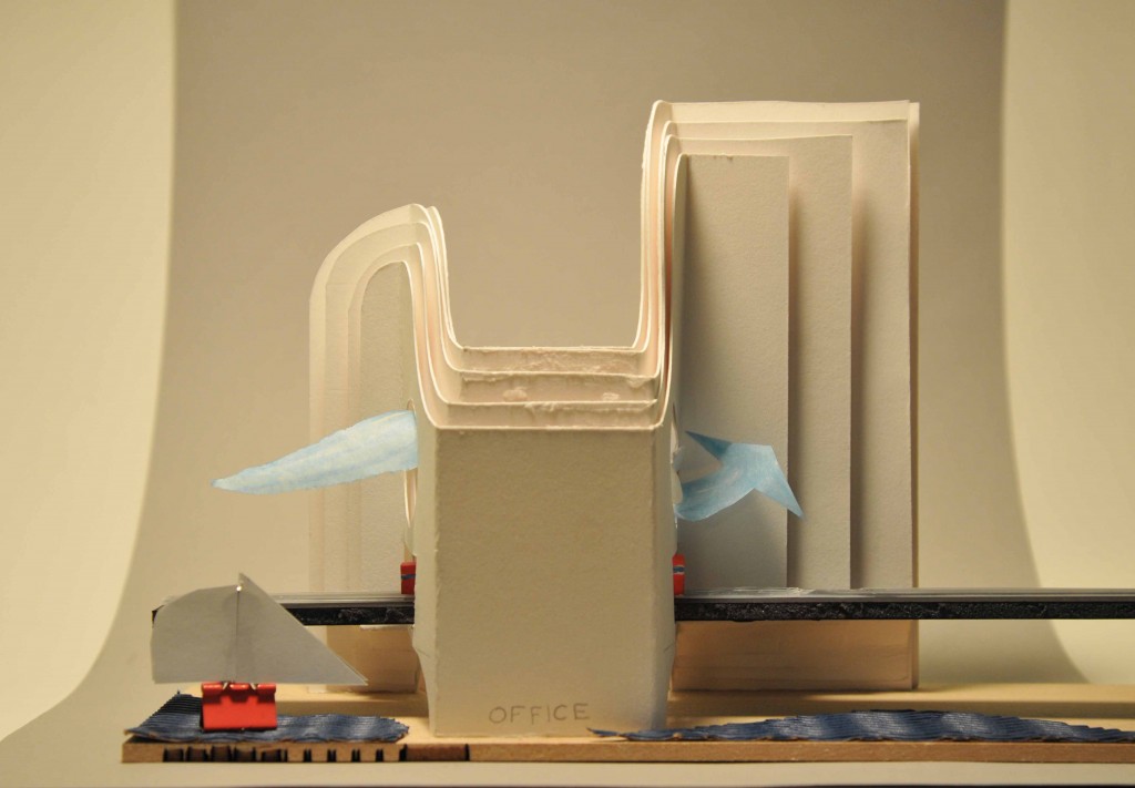
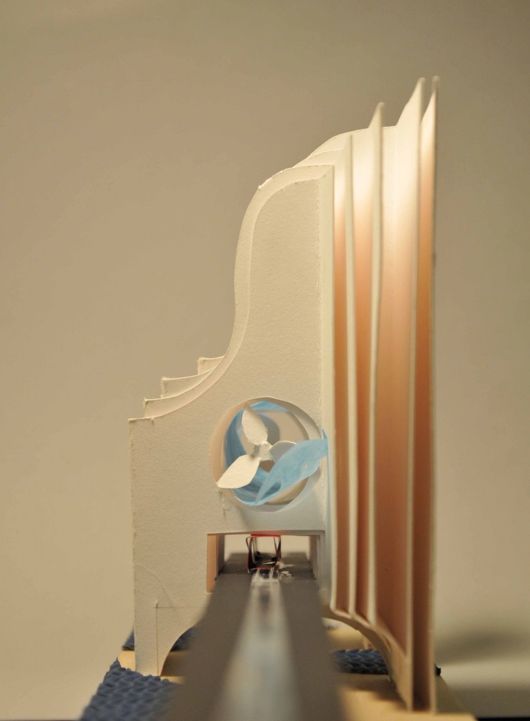
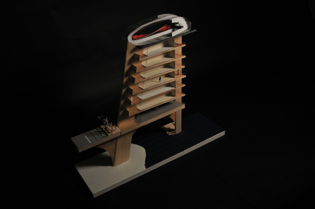
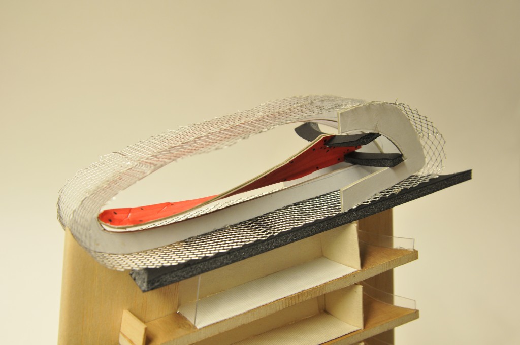
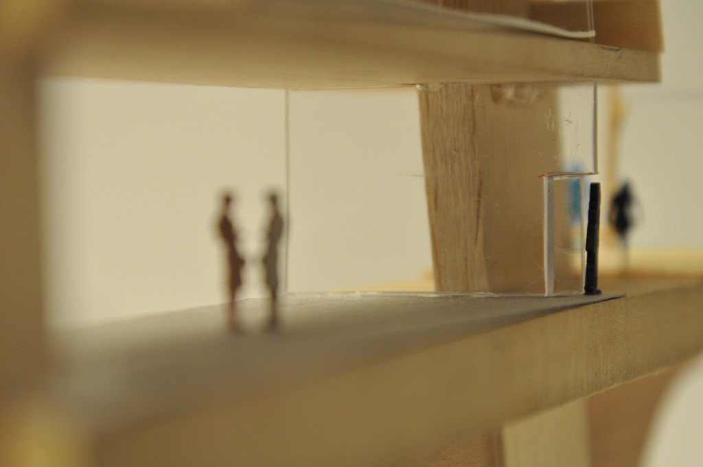
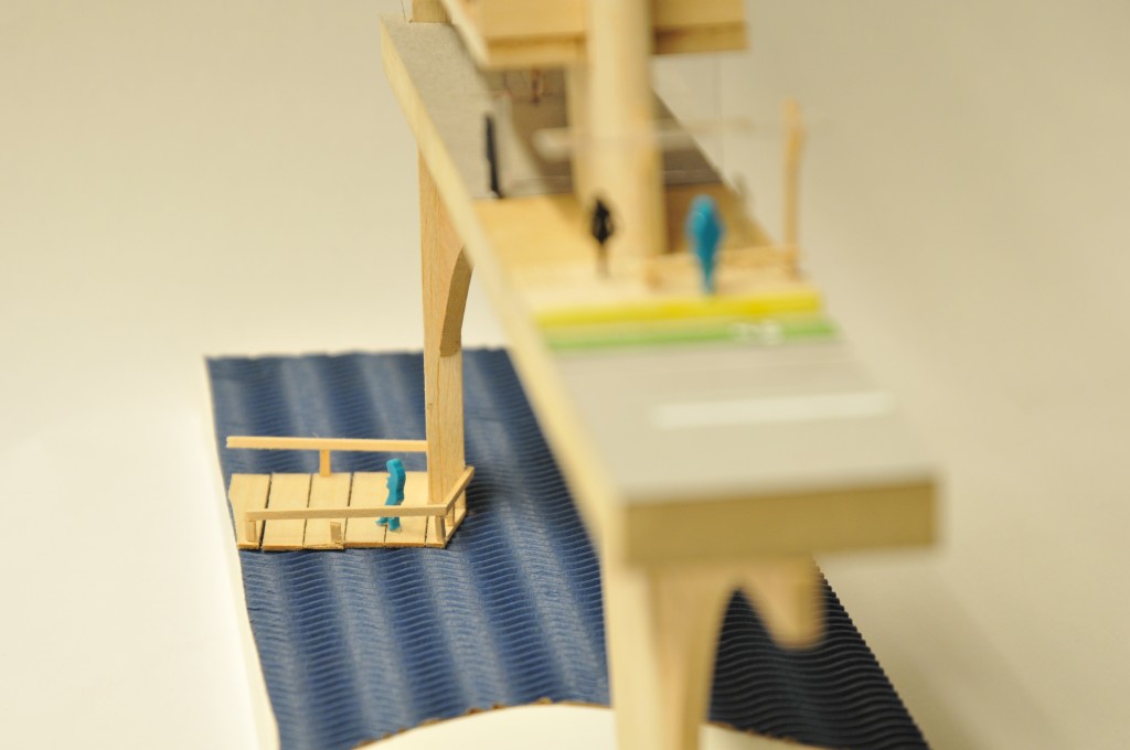
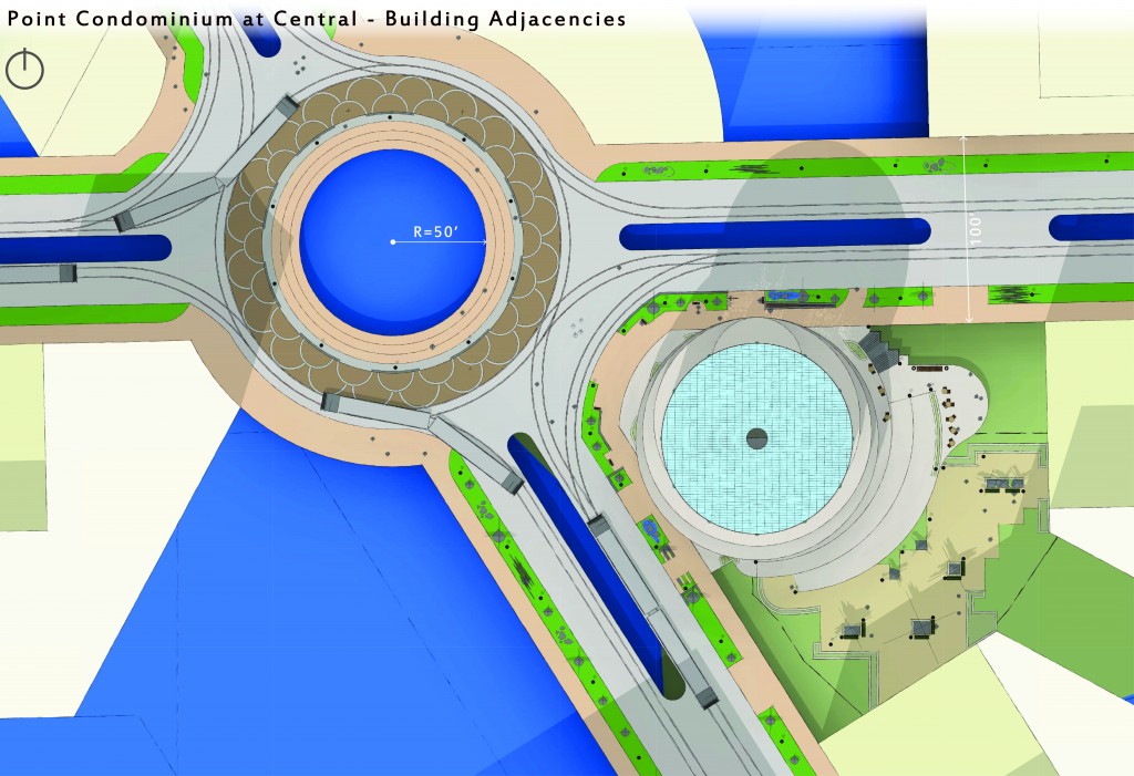
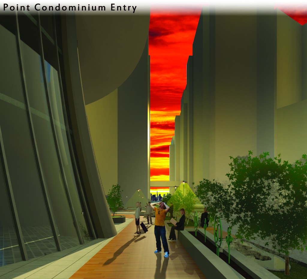
Study Model
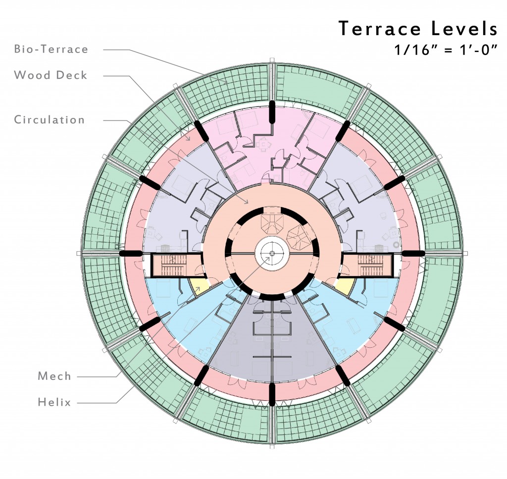
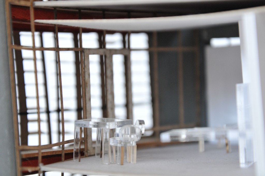
2″ Wide by 18″ long by 18″ tall. This model shows a sliver of the proposed building, human spaces and relation to both the elevated street interface and the canals below.

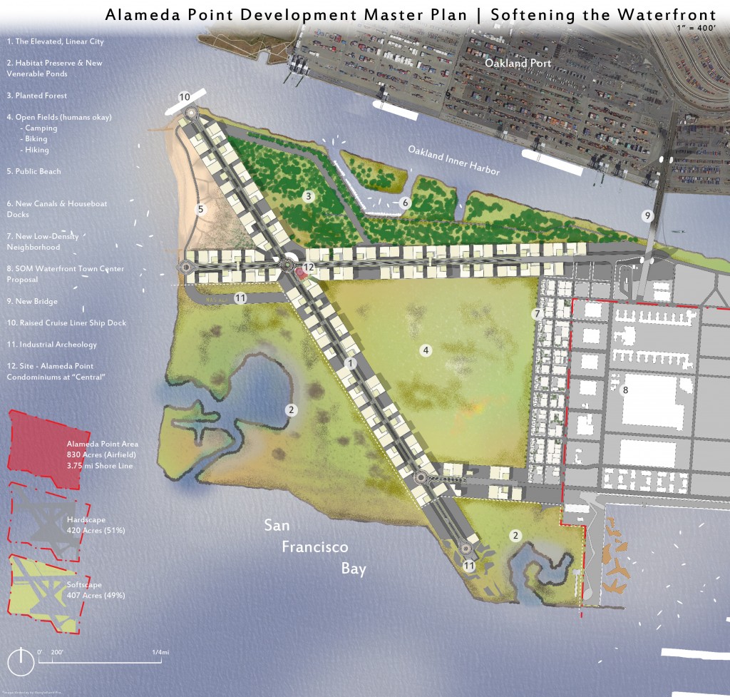
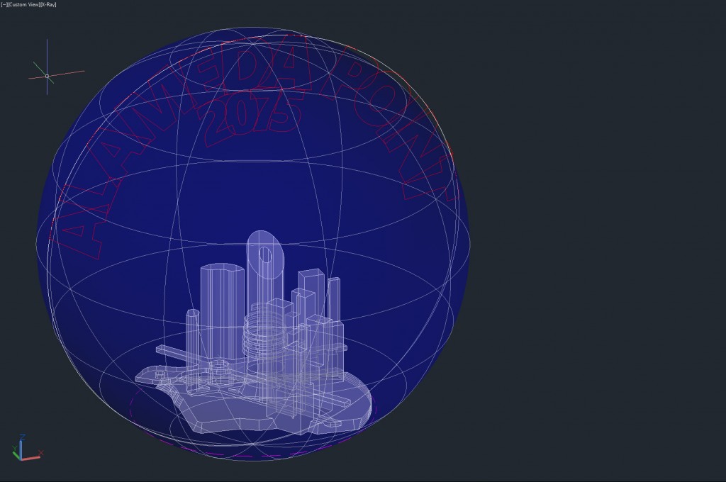
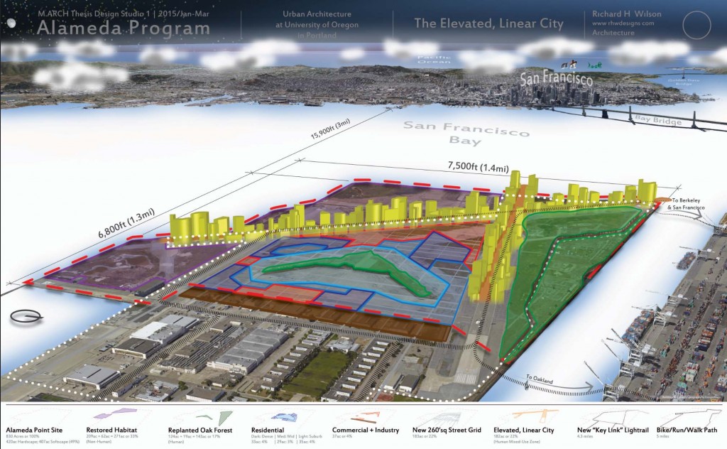
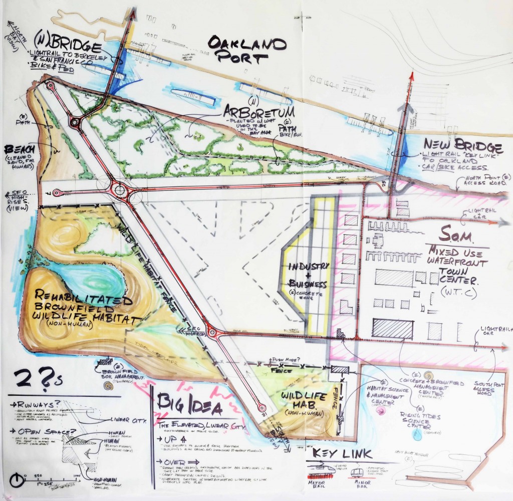
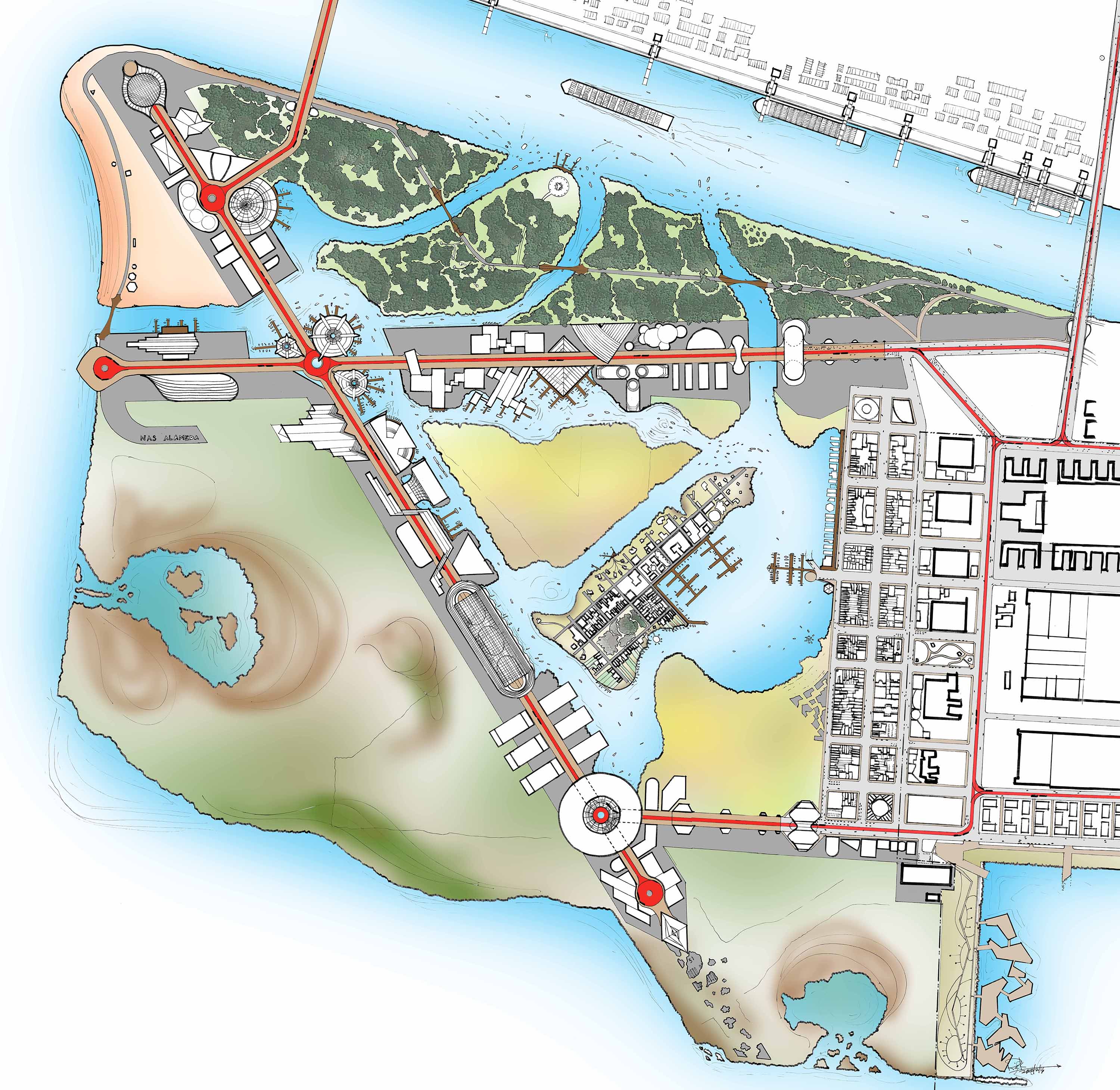
Year 2075 Illustrative Master Plan
48″ square hand drawing, at 1″ = 200′, with Photoshop overlay. Although the intended graphic representation was not achieved, methods for creating watercolor-like computer generated images is still being explored. This plan shows very specific details of what this Elevated, Linear City may look like as a result of context and constraints. However the more likely condition of Alameda Point in 2075 would be under water for portions of the day with the rising sea level. See the Waters of the Bay section above for imagery of the 100-year flood expectation.
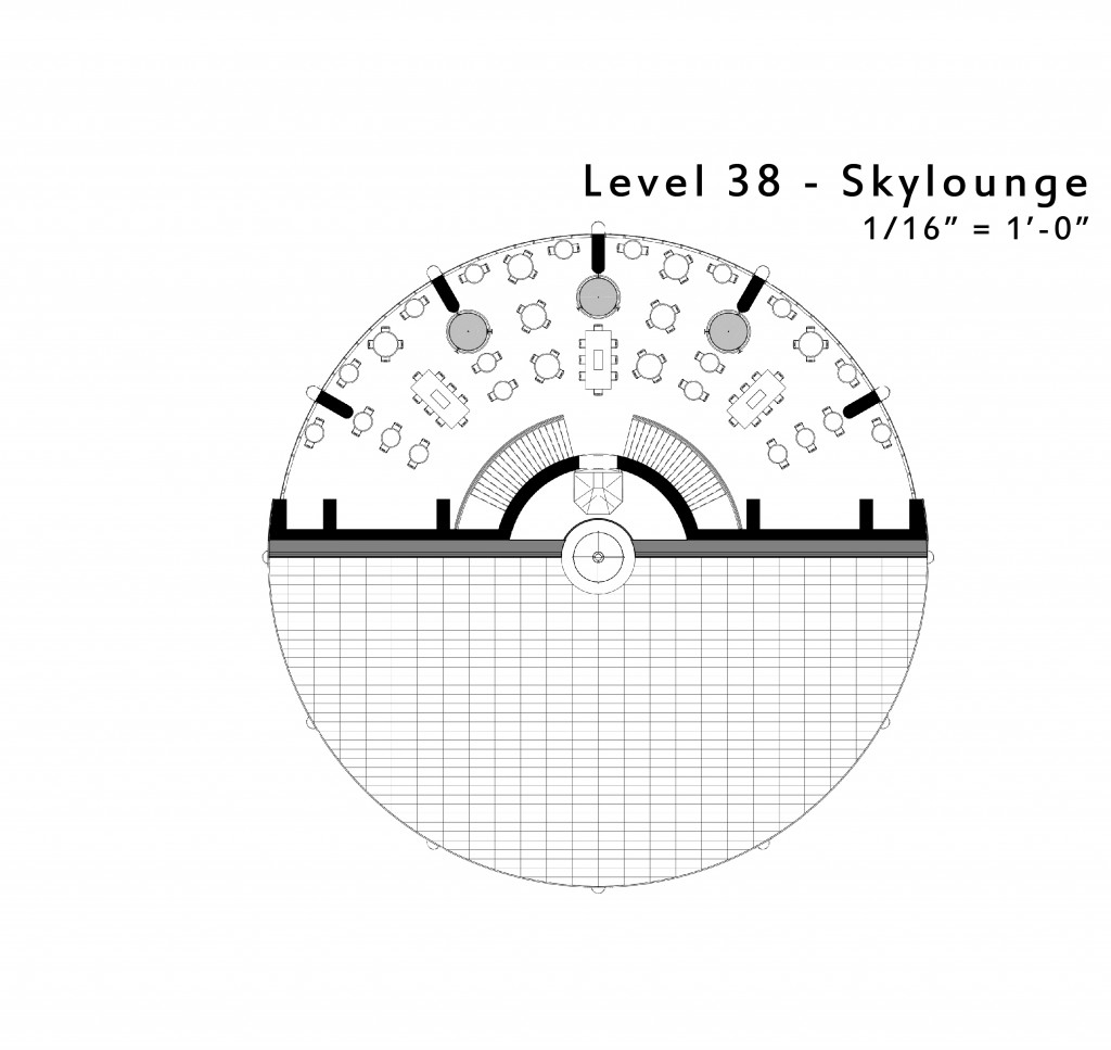
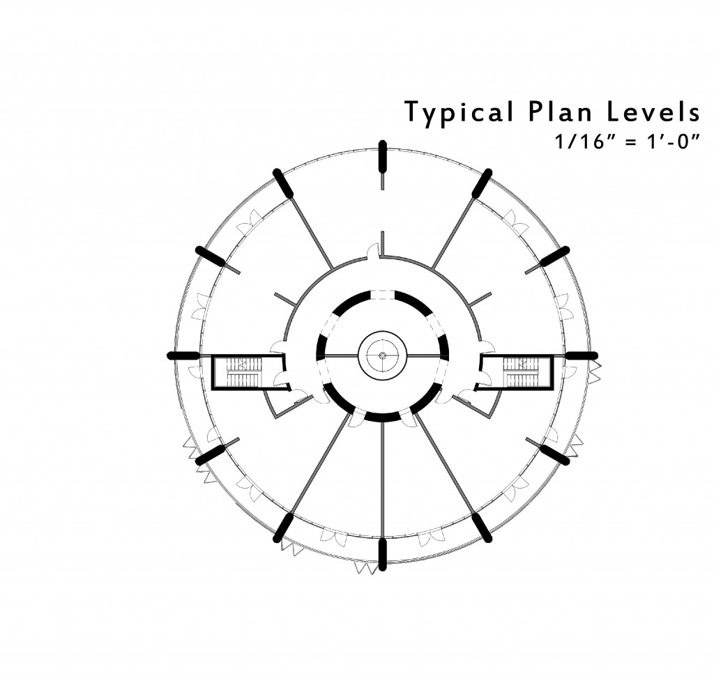
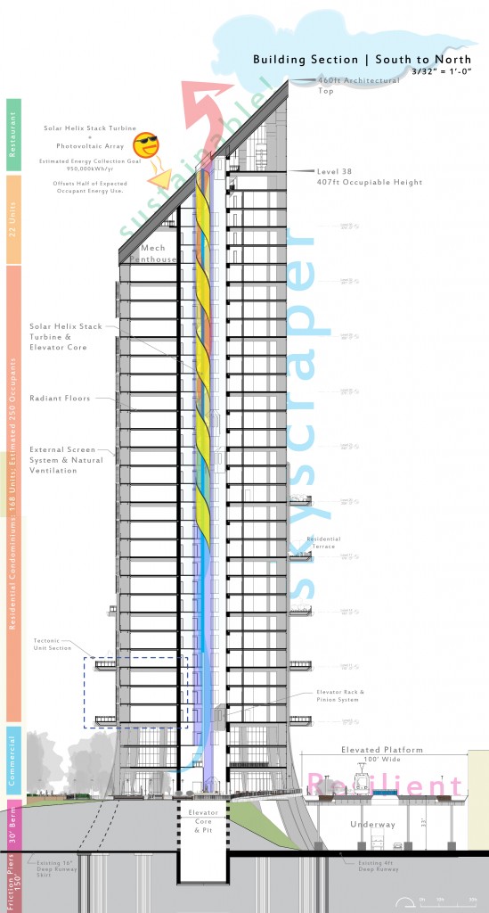
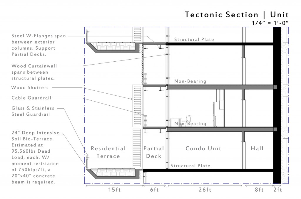
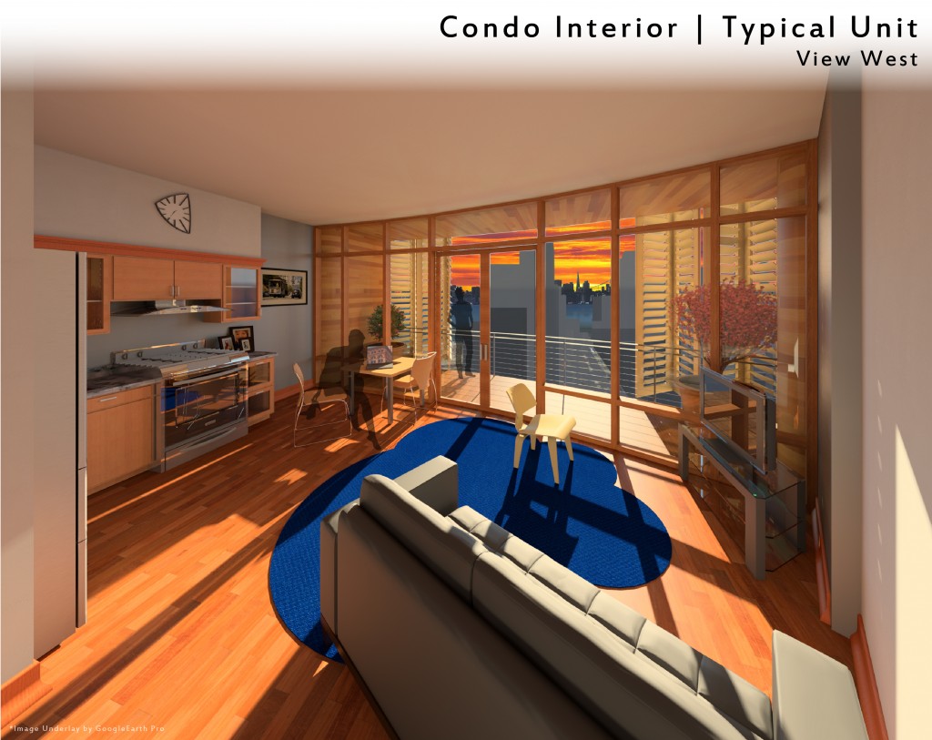
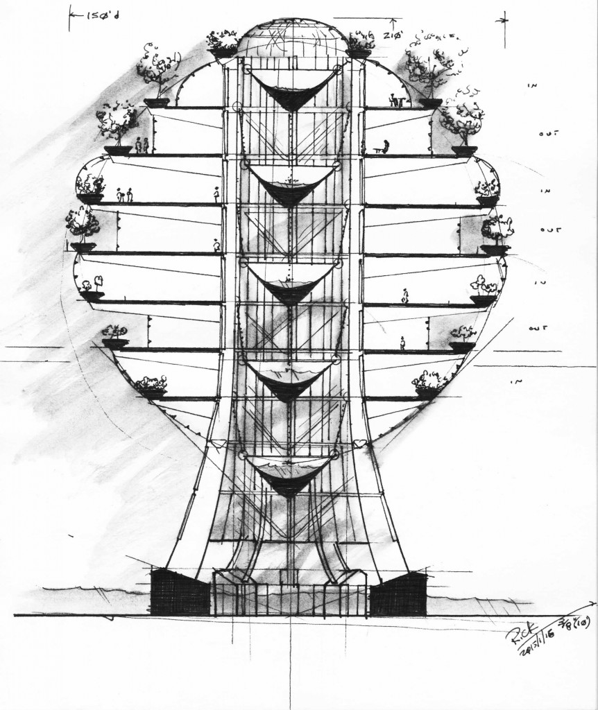
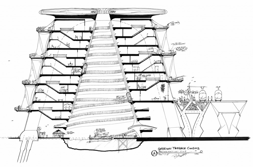
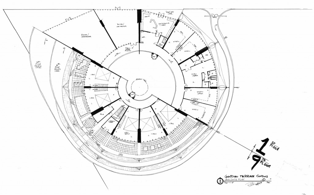
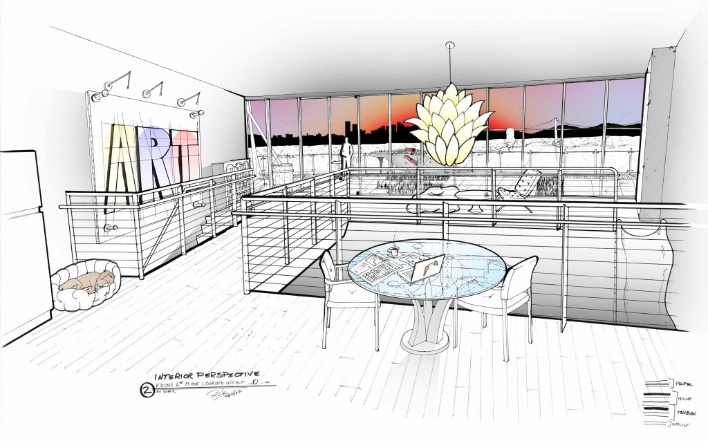
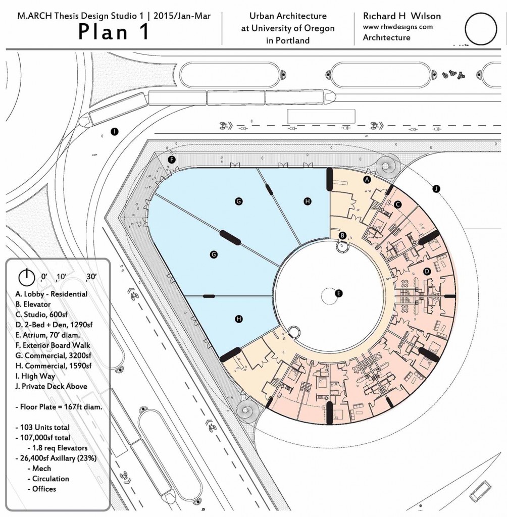
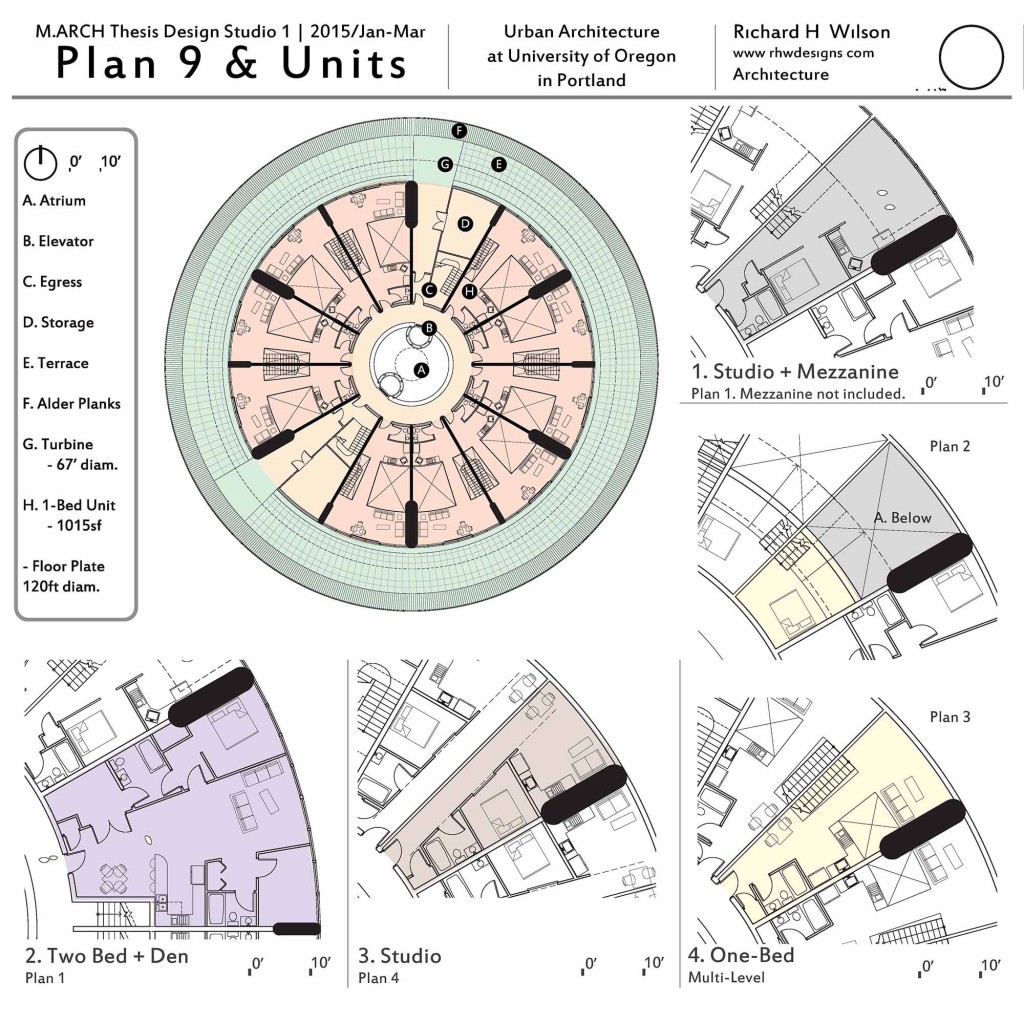
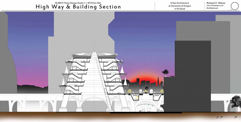
Plan, Section and Interior Perspective
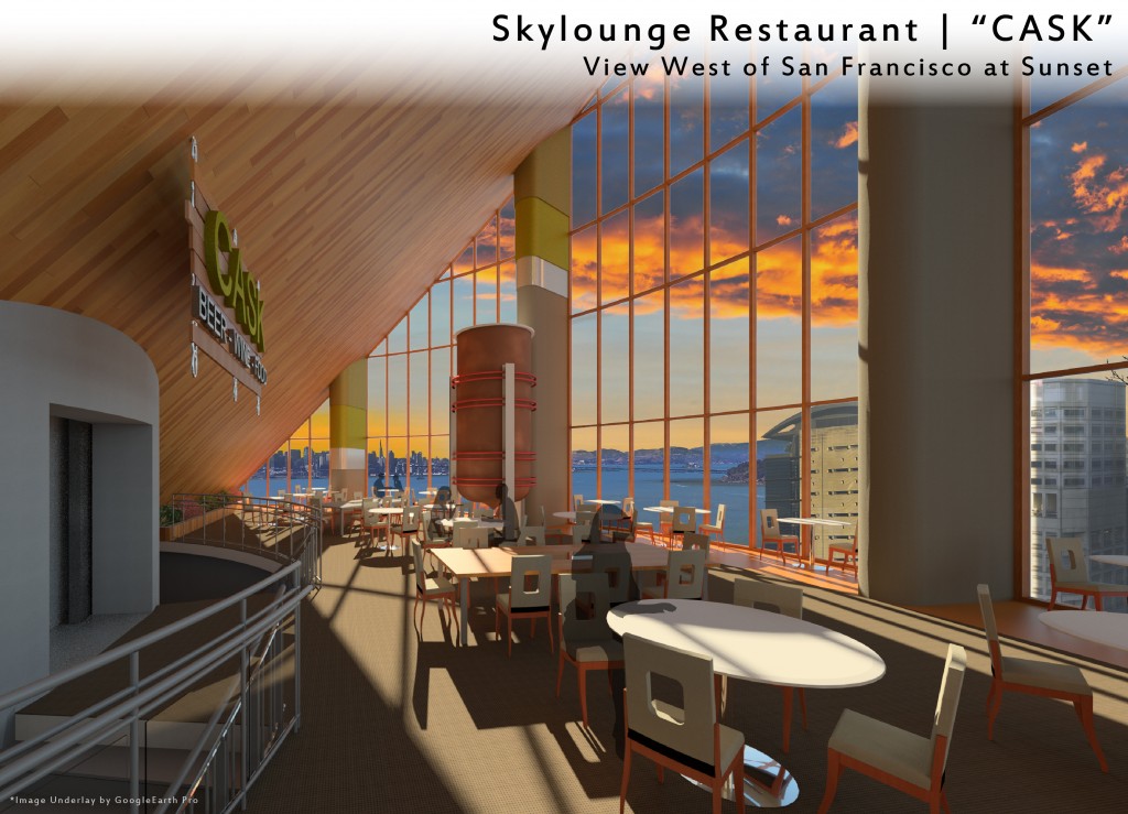
Each drawn at 24″x36″; the plan and section were at 3/32″ = 1′-0″ scale. The Section, requiring the most intensive thought, took 20 hours to develop. The Plan, developed after completion of the Section, took 7 hours. The Interior perspective was generated by first putting together some quick line-work in AutoCAD Architecture based on the Plan and Section, then traced over for a human touch; it was then lightly rendered in Photoshop. This drawing took 8 hours.
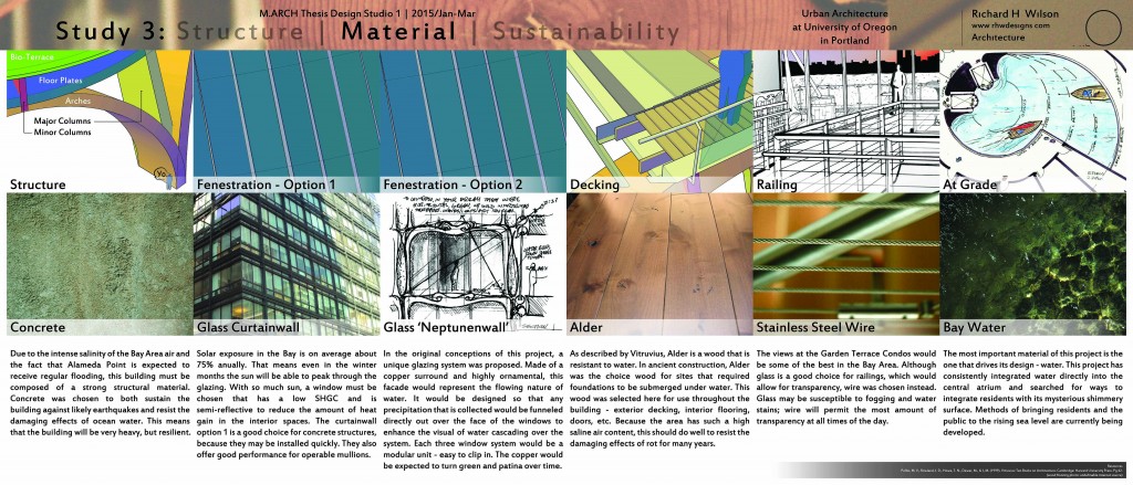
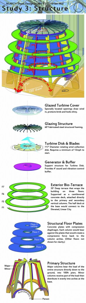
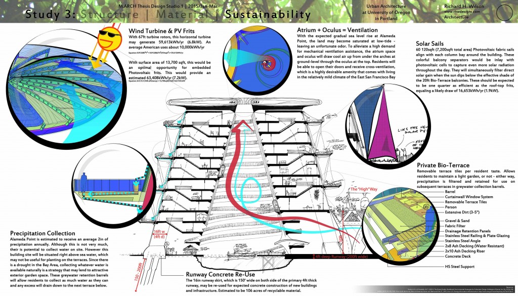
Study #3: Tectonic Concepts
A fast, one-week, research study into three tectonic areas of design: Structure; Material; Sustainability. Each board was designed with its function in mind and each showed exactly what it needed to for effective design intent communication.
The building plans and visualization were the primary focus. All as a result of the three main goals, Resiliency, Waterfront Reclamation and Compact Development.
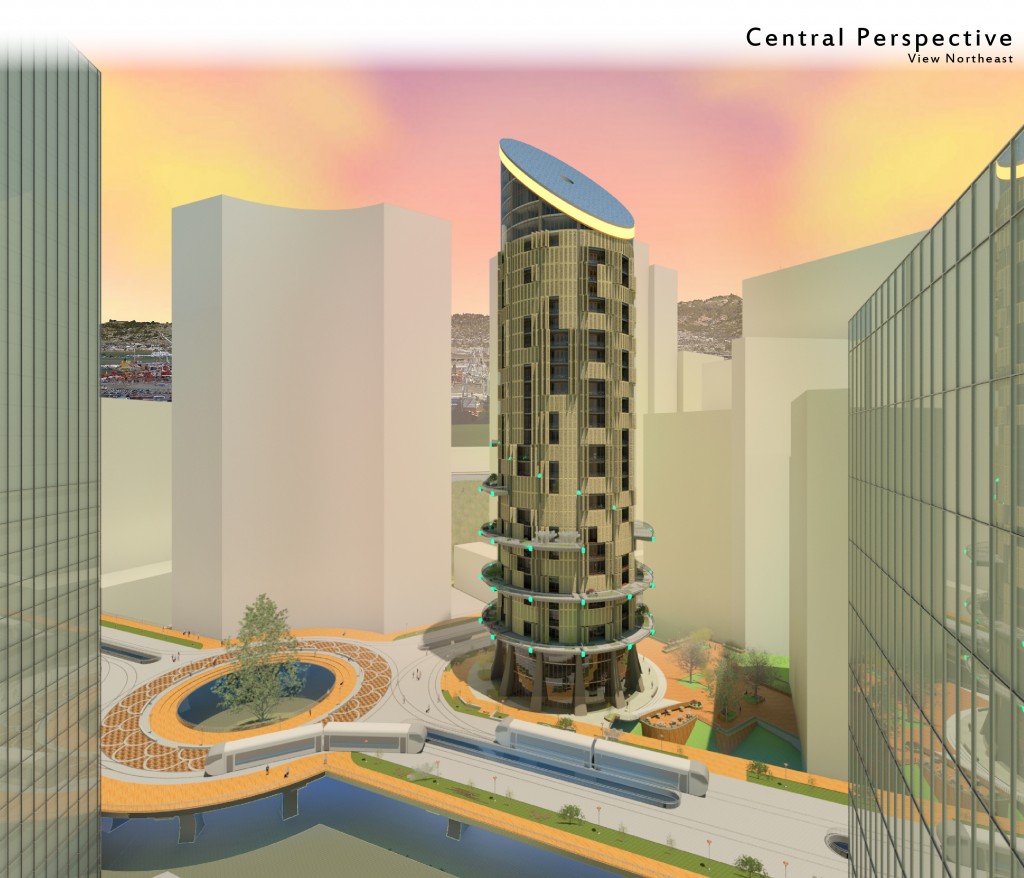
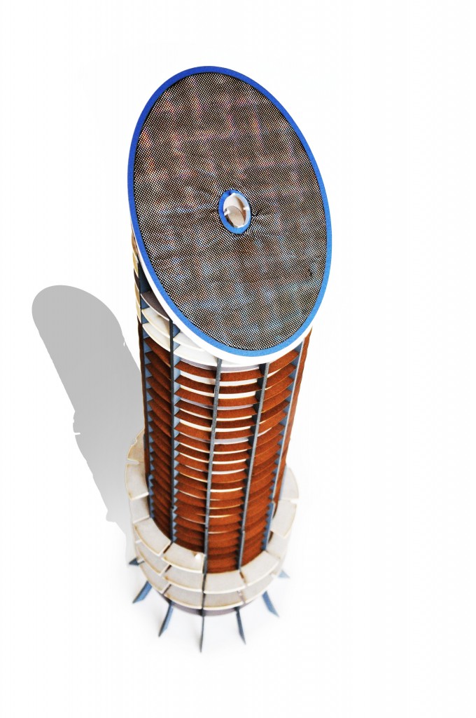
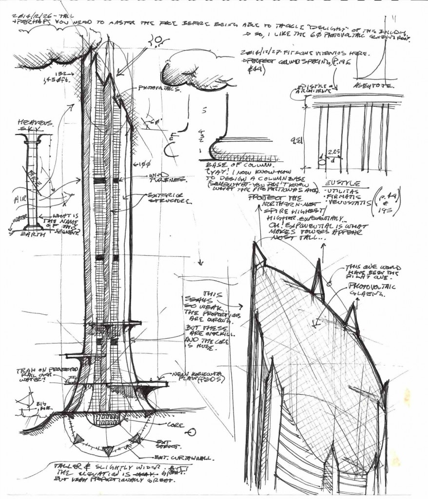
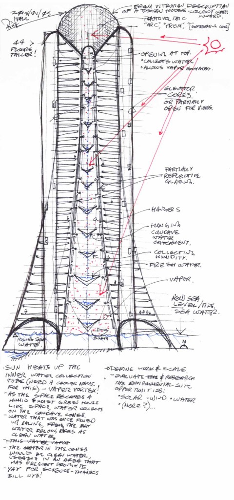
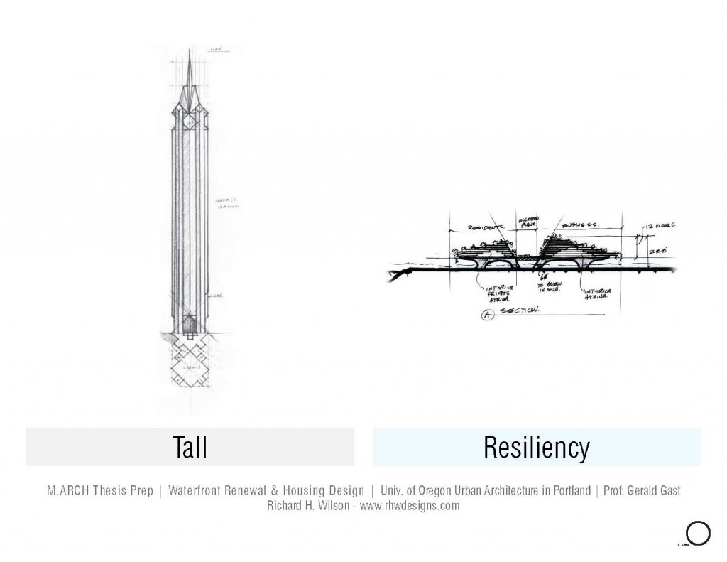
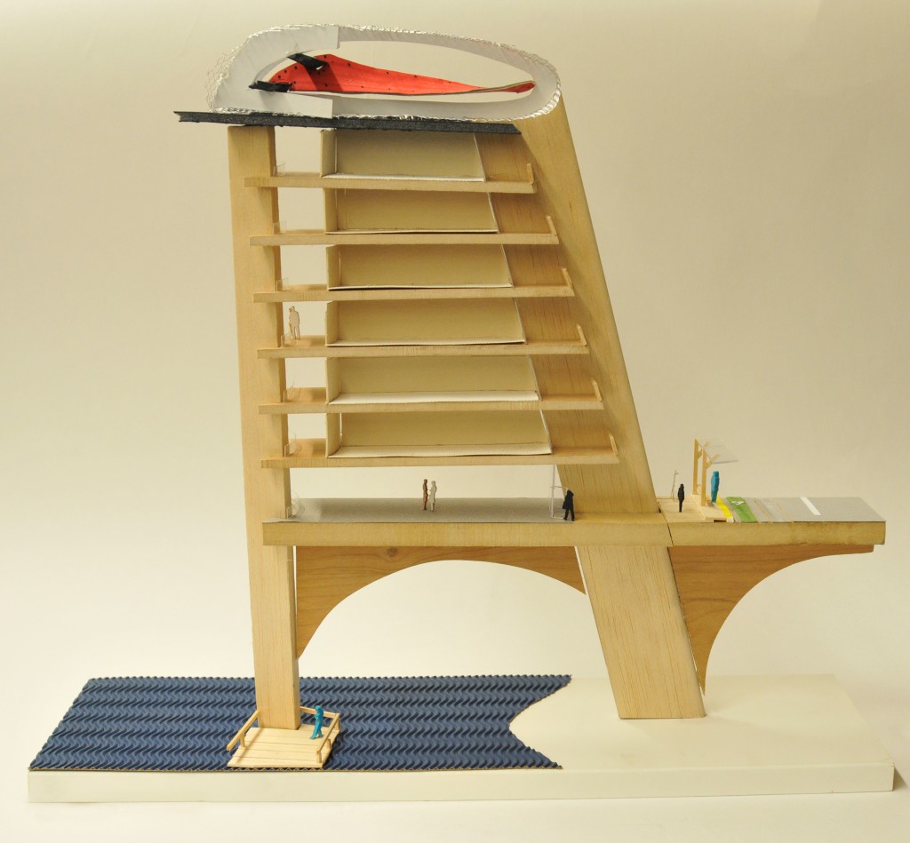
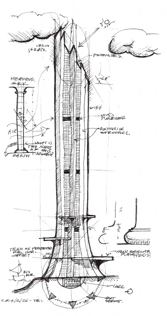
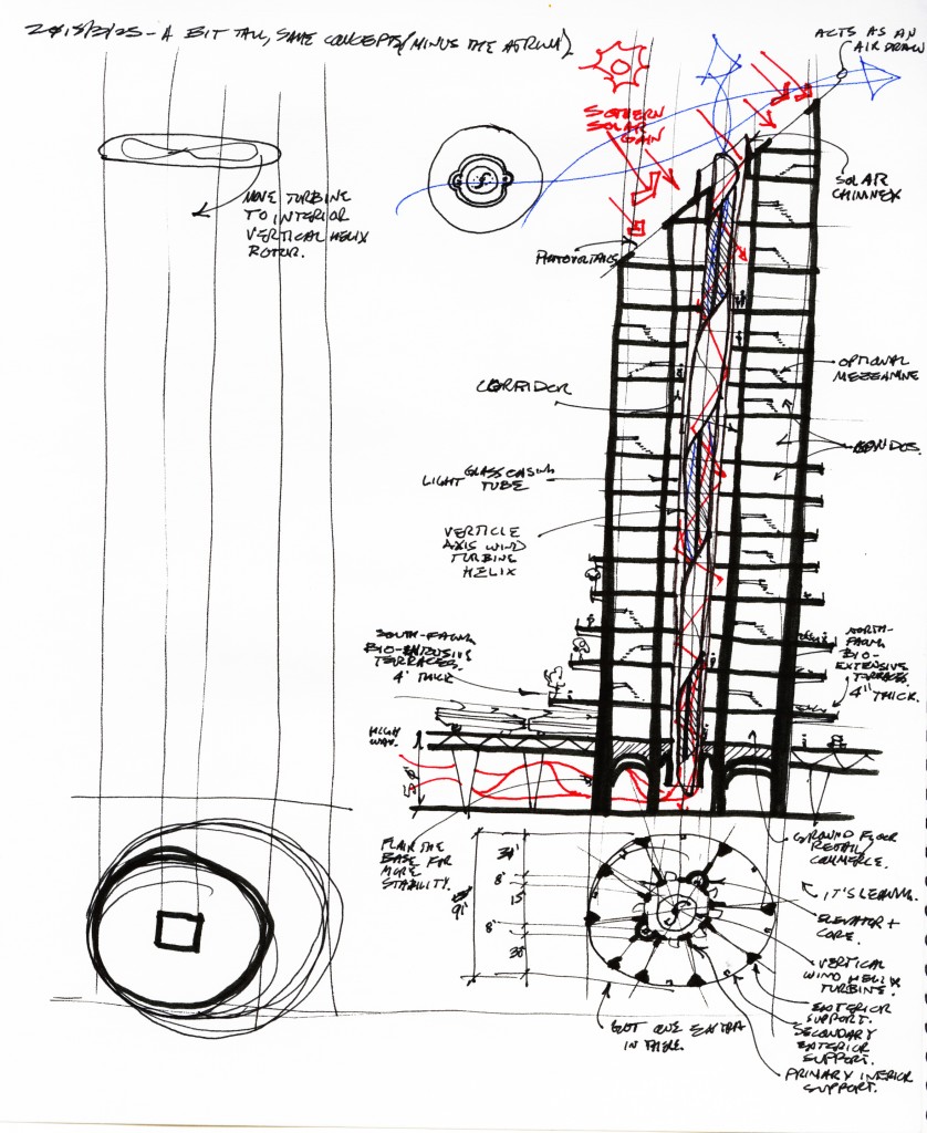
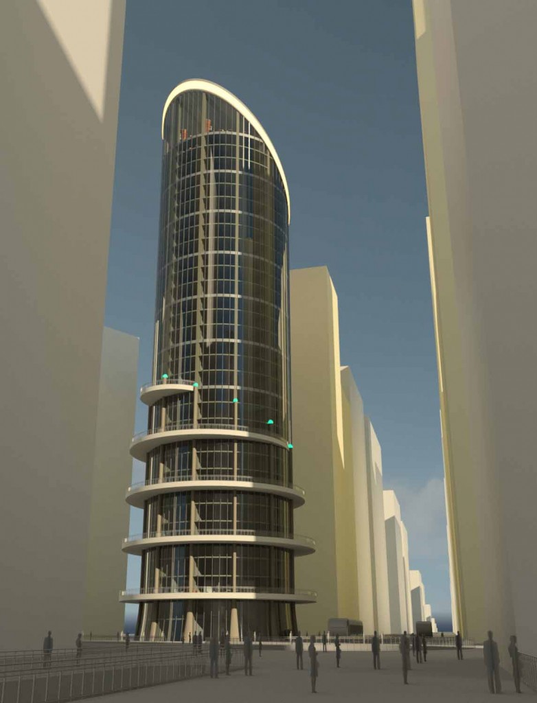
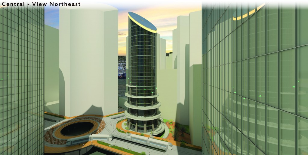
“Tall”
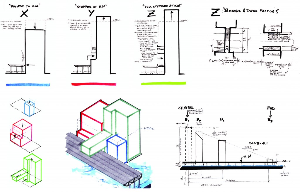
The original program for a skyscraper has returned and with it the original project name: Tall. All of the concept designs from the past three months have remained. However the aesthetic and capacity, as well as specific approaches to design, have altered. Before suggestion from Gerald Gast, professor of architecture at the UO Portland, the plan was to create a linear city that rose as one traveled closer to the center. The Alameda Point Towers, consisting of a Business Center, Hotel and Condominium, were slated to be the tallest buildings at the center. An early sketch of the original program and design may be seen below, with a design development sketch and finally the most recent rendition of the building.
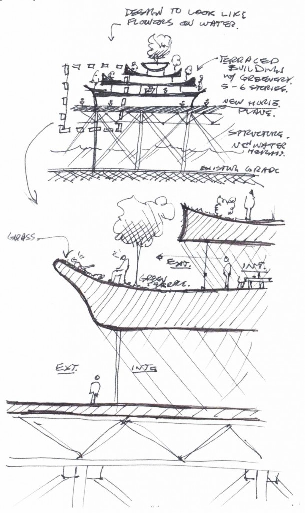
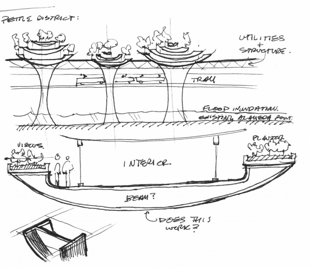
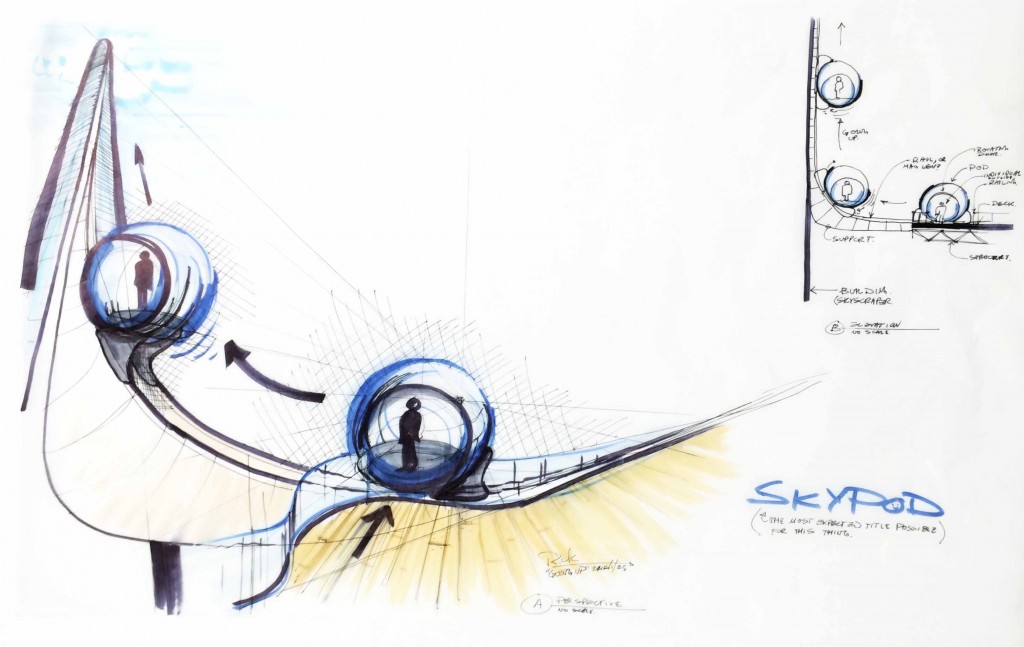
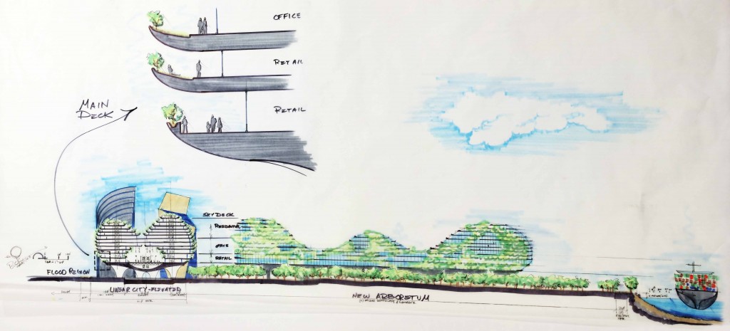
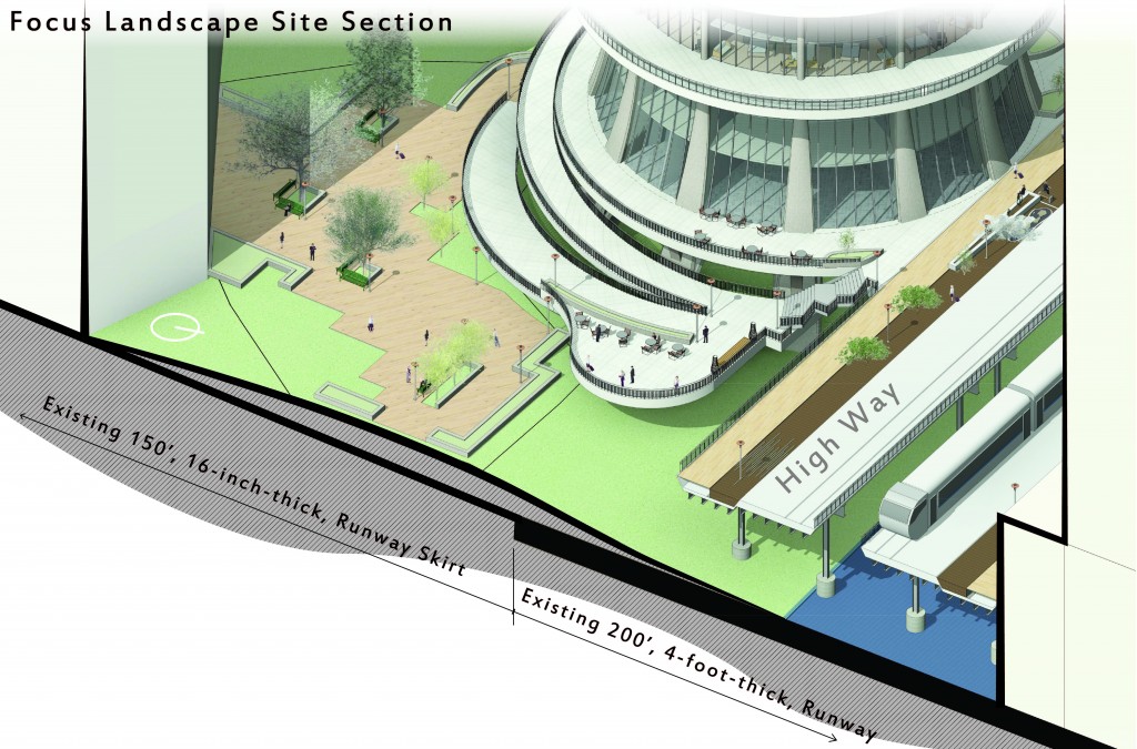
Study #4: Landscape Design
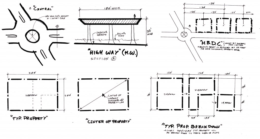
When a site is 830 acres, landscape design may become a general exercise. However, if 100% of the land will be flooded with water, naturally over the years, that focus may be shifted. In this case, the focus looked up to a new plane of existence – 33-feet off the existing grade.

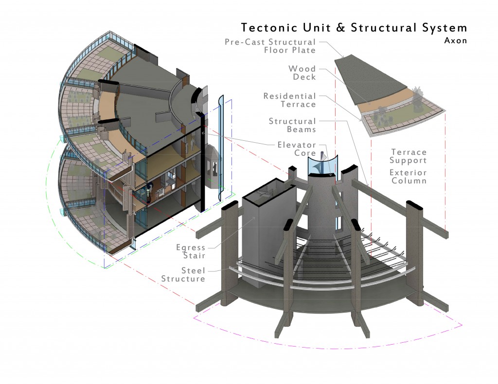
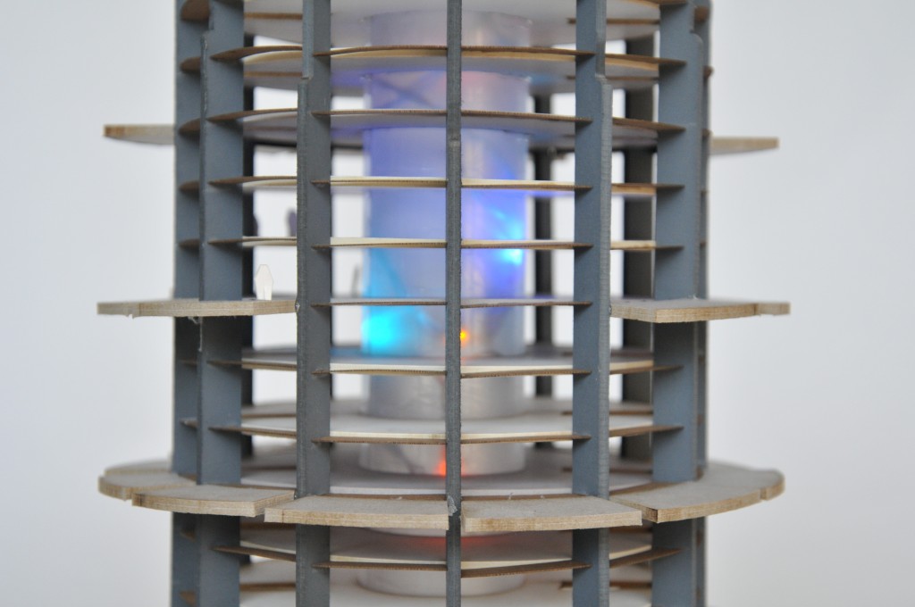
Study #5: Structural Considerations
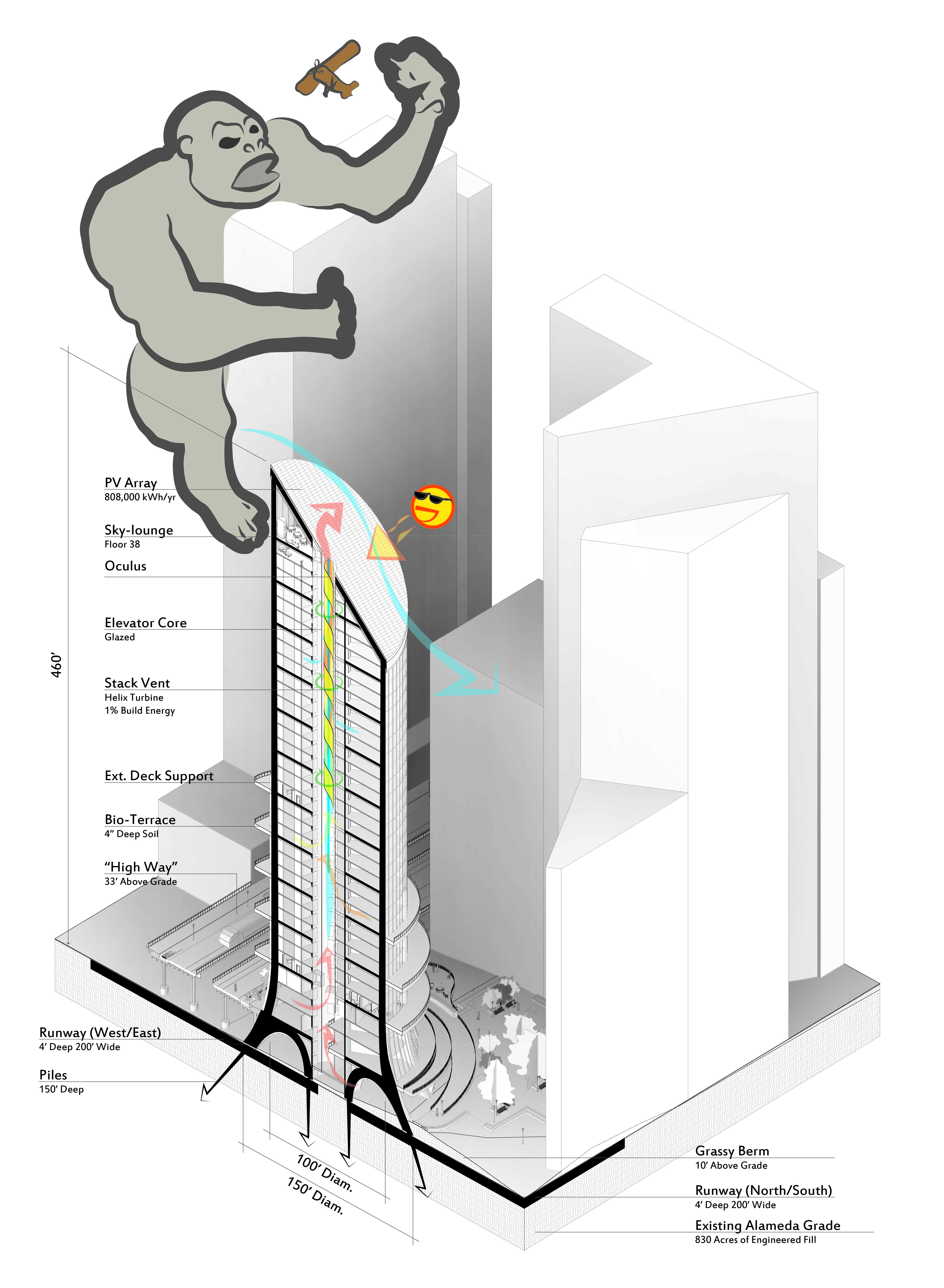
Autodesk Revit exploration of design communication, mixed with Illustrator. King Kong was requested to point out some of the major system components of the Point Condos. Unfortunately, the lovable giant became distracted.
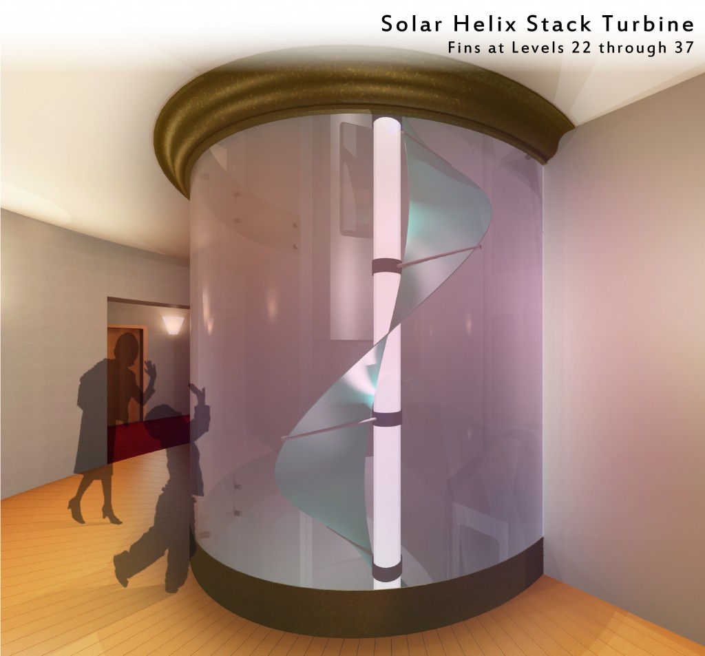
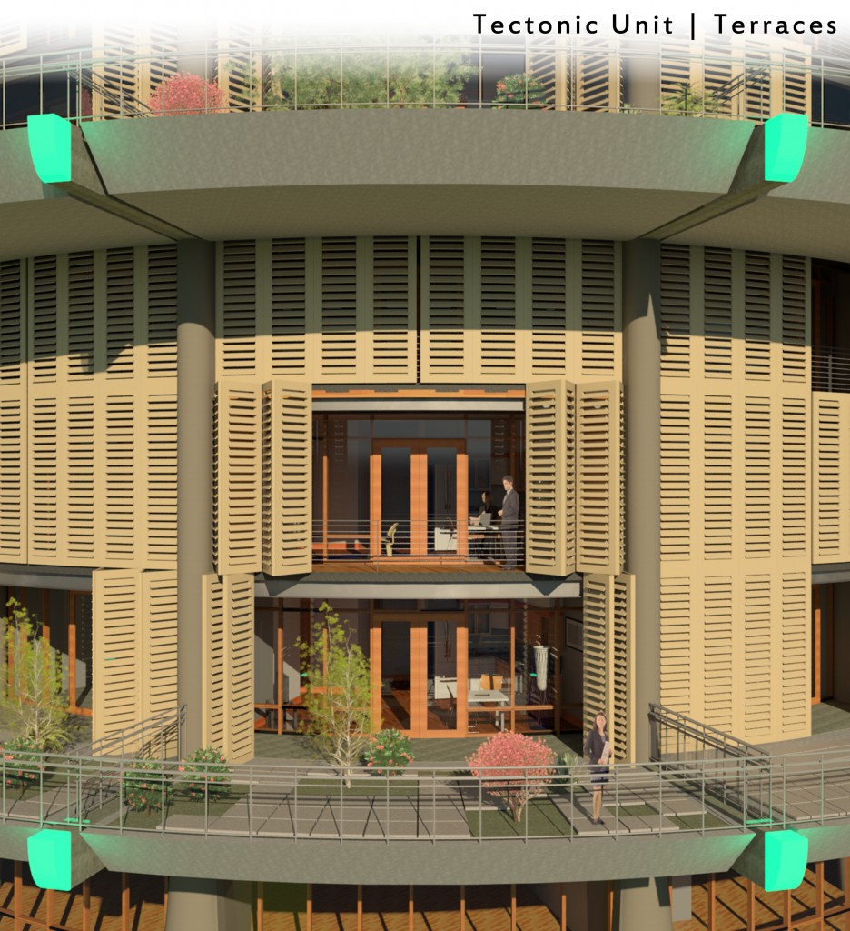
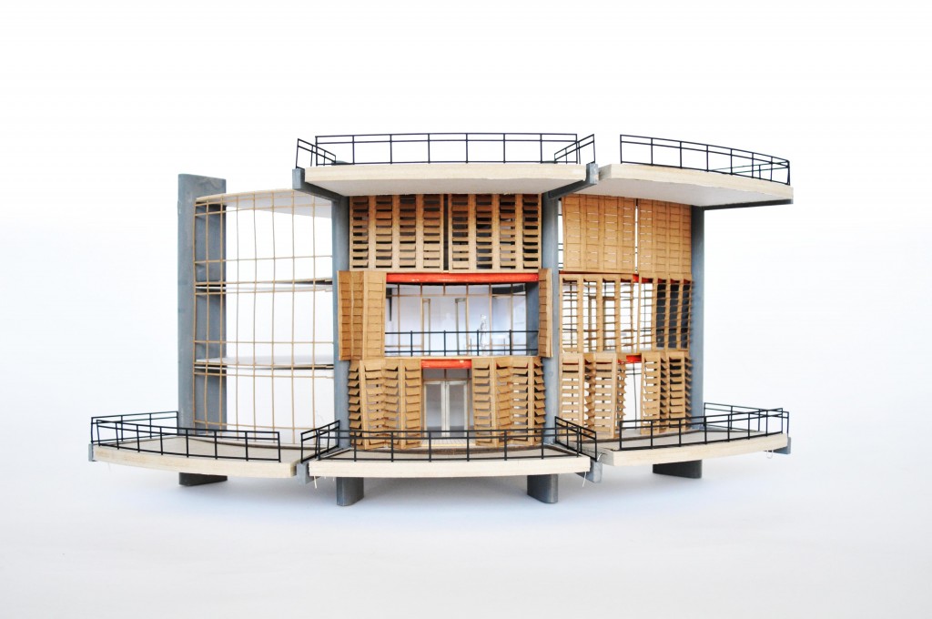
Study #6: Tectonics & Place
The recent challenge of the project was to properly handle solar exposure. The solution to solar gain finally came to a wood shutter system, which compliment the timber curtainwall and wood flooring. The Alameda Point Condominium has risen to be a dynamic and exciting project. It maintained the original goals of Waterfront Reclamation, Resilient Design and Compact Urban Development.
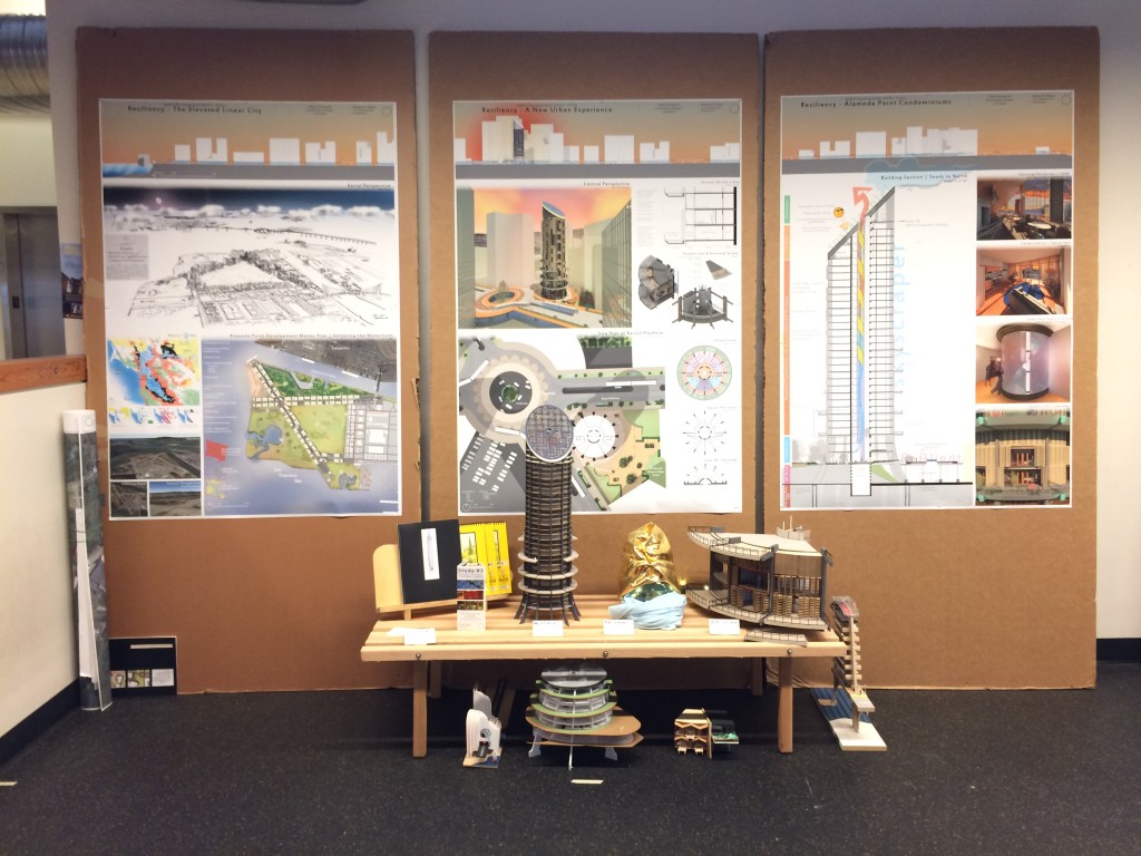
The final result of the entire project.